Upper Summit Trail Closure Planned At Mount Pisgah June 17–19 (Photo)
- 06/15/26
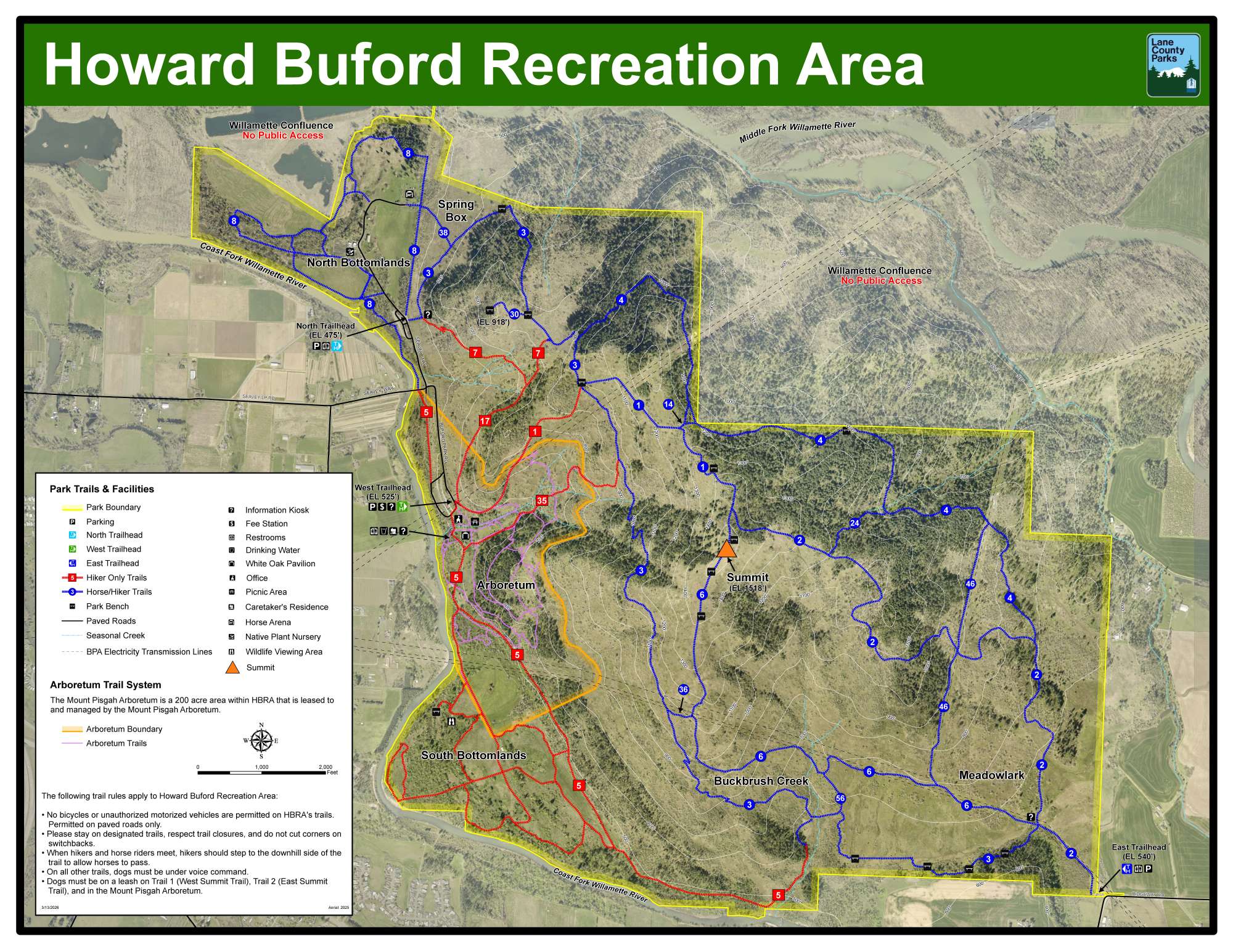
Lane County Parks will temporarily close the upper section of Summit Trail 1 at Mount Pisgah (Howard Buford Recreation Area) from June 17 through June 19 to allow crews to safely complete trail improvement work.
The closure affects the final half-mile segment of the trail leading to the summit. Work, being completed by Oregon Woods, includes the removal of large rocks and trail obstacles, construction of drainage features to reduce erosion, and placement of new gravel to improve trail stability, accessibility, and drainage.
During the closure, summit access will be available only via Trail 6. Access from Trail 2 will also be unavailable, as Trail 2 connects to the upper section of Trail 1 near the summit.
Trail closure signs will be posted at access points, and visitors are encouraged to plan ahead and use alternate routes within the park.
###
Upper Summit Trail Closure Planned At Mount Pisgah June 17–19 (Photo)
- 06/15/26
Lane County Parks will temporarily close the upper section of Summit Trail 1 at Mount Pisgah (Howard Buford Recreation Area) from June 17 through June 19 to allow crews to safely complete trail improvement work.
The closure affects the final half-mile segment of the trail leading to the summit. Work, being completed by Oregon Woods, includes the removal of large rocks and trail obstacles, construction of drainage features to reduce erosion, and placement of new gravel to improve trail stability, accessibility, and drainage.
During the closure, summit access will be available only via Trail 6. Access from Trail 2 will also be unavailable, as Trail 2 connects to the upper section of Trail 1 near the summit.
Trail closure signs will be posted at access points, and visitors are encouraged to plan ahead and use alternate routes within the park.
###