FLAT FIRE ROAD CLOSURE UPDATE: SUNDAY AUGUST 24TH, 2:25 P.M. (Photo) - 08/24/25
***CORRECTION***
The road closure update is for Sunday, August 24, not Saturday, as stated in the original news release. We apologize for the error.
Sisters, Ore. -- The Deschutes County Sheriff’s Office is providing an update on road closures associated with the Flat Fire. Community members have been asking questions about access in the affected areas.
There are currently four primary road closures:
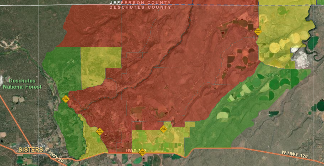
- Wilt Road is closed at Camp Polk Road
- Panoramic Drive is closed at Camp Polk Road
- Goodrich Road is closed north of Hwy 126
- Holmes Road is closed north of Fadjur Lane
For visual reference, a map has been created showing these closures. Yellow road signs on the map indicate closure points.
The map also highlights evacuation zones:
-
Red – Level 3 (Go Now)
-
Yellow – Level 2 (Be Set)
-
Green – Level 1 (Be Ready)
We encourage residents to monitor official updates and remain aware of changing conditions.
###