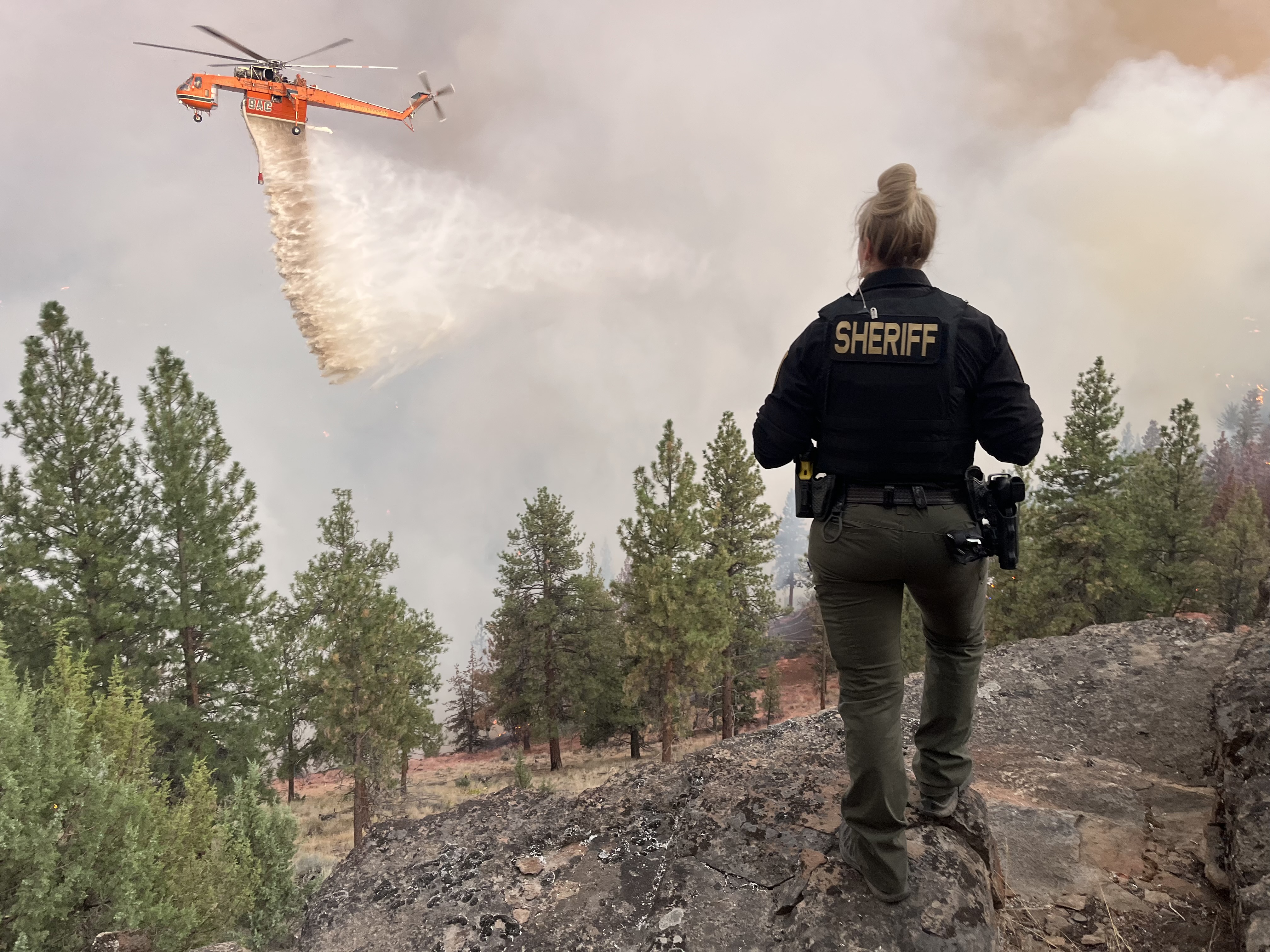
Evacuation Update: Aspen Lakes Subdivision And Edmunson Road Areas Added To Level 3, Go Now! (Photo) - 08/23/25
***FLAT FIRE EVACUATION UPDATE: Saturday, August 23rd, 8:08 p.m.***
The major update is that Aspen Lakes Subdivision off Camp Polk Road has been elevated to a Level 3 (Go Now) Evacuation order, along with both sides of Edmundson Rd between Holmes Rd and Goodrich Rd
Here is the latest information from fire managers:
After consulting with local Fire Chiefs and incident commanders, the Deschutes County Sheriff’s Office has updated evacuation levels as the Flat Fire continues to grow and move. Based on the current and potential fire behavior today the following areas are now under Level 3 (GO NOW), Level 2 (GET SET), and Level 1 (BE READY) evacuation notices.
Large animals have been offered shelter at Kerley Horse Center, 11997 SW Cornett Loop, Powell Butte, OR 97753, 541-598-6358.
LEVEL 3 (GO NOW):
-
Aspen Lakes Subdivision off of Camp Polk Road
-
Both sides of Edmundson Rd between Holmes Rd and Goodrich Rd
-
Between Wilt Rd MP 4 West to Stevens Canyon North to the County Line
-
Whychus Canyon Estates south to Camp Polk Rd to
-
Both sides of Wilt Road north to the Deschutes/Jefferson County line
-
Areas North and West of Holmes Road, North of milepost 5 to Lower Bridge Rd
-
All of McKenzie Canyon Rd
-
Panoramic Estates off of Camp Polk Road
Level 3: Means “GO” evacuate now. Leave immediately! Danger to your area is current or imminent, and you should evacuation immediately. If you choose to ignore this advisement, you must understand that emergency services may not be available to assist you further. DO NOT delay leaving to gather any belongings or make efforts to protect your home. This will be the last notice you receive.
LEVEL 2 (GET SET)
-
Area between Camp Polk rd, West along HWY 126 to include the Junipine Ln area and north to Old Military Rd
-
Area North and East of Lower Bridge Rd to the Deschutes River
-
Areas north of Hwy 126, including Goodrich Road, Holmes Roa,d and Fadjur Lane
Level 2: Means “BE SET” to evacuate. You must prepare to leave at a moment’s notice. This level indicates significant danger to your area, and residents should either voluntarily relocate to a shelter or with family and friends outside of the affected area, or if choosing to remain, be ready to evacuate at a moment’s notice. Residents MAY have time to gather necessary items, but doing so is at their own risk. This may be the only notice you receive. Emergency services cannot guarantee that they will be able to notify you if conditions rapidly deteriorate. Area media services will be asked to broadcast periodic updates.
LEVEL 1 (BE READY):
-
Areas on the North side of East Indian Ford Road, from Wilt Rd to FS Rd 2050, including Stevens Canyon Road to MP 1.5, Fox Ridge Circle, and Pine Ridge Road.
-
Dry Canyon area between Lower Bridge Rd, South to Hwy 126
-
The area between Indian Ford Creek and Wychus Creek, north of Hwy 126 to the Camp Pollk Rd/Wilt Rd intersection, includes Indian Ford Ranch, Deer Ridge, Pine Ridge Loop, and McKinney Butte Subdivisions.
Level 1 Means “BE READY“ for potential evacuation. Residents should be aware of the danger in their area and monitor emergency services websites and local media outlets for information. This is the time for preparation and precautionary movements of persons with special needs, mobile property, and (under certain circumstances) pets and livestock. Emergency services personnel may contact you via an emergency notification system if conditions worsen.
A Temporary Evacuation Point at Highland Baptist Church is located at: 3100 SW Highland Ave, Redmond, OR.
Recreational Vehicle (RV) owners can park in the paved parking lot of the Deschutes County Fair and Expo Center through Tuesday, August 26.
Jefferson County Fairgrounds is available for large animals and support is being provided by the Pet Evacuation Team.
We will continue to work closely with fire managers and provide updates as the situation develops. Please follow official channels for accurate information.
Current maps, including evacuation areas, can be found at: https://deschutes.org/emergency
For fire information, you can visit the Central Oregon Fire Information site at: www.centraloregonfire.org and follow the Flat Fire on Facebook.
Make sure you are registered for Deschutes Alerts to receive evacuation and emergency alerts and warnings in your area by going to www.deschutesalerts.org
###