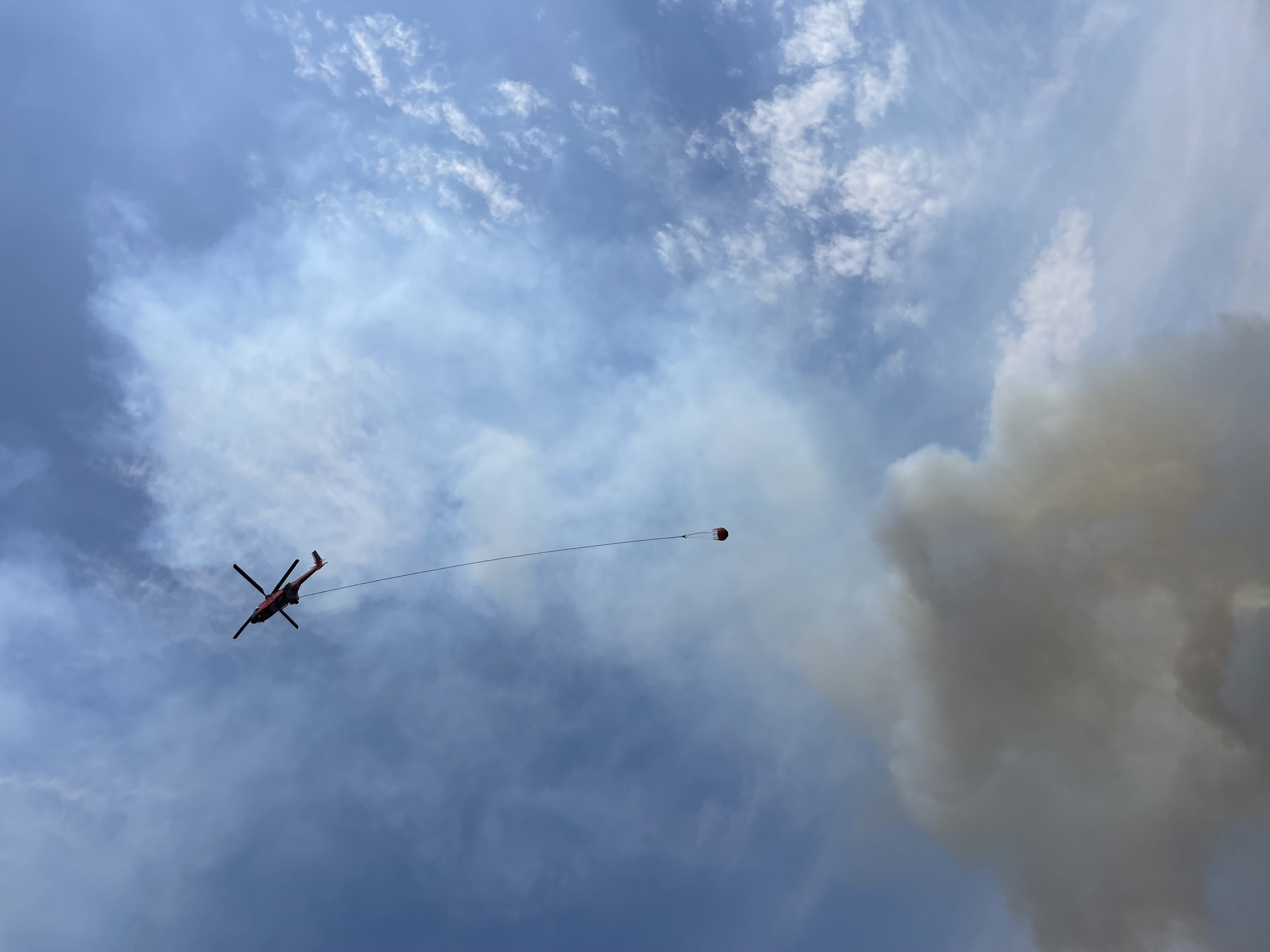
Mile Marker 132 Fire (Photo) -08/07/24
***UPDATE August 7, 2024 - 4PM***
After consultation with fire managers, the Deschutes County Sheriff's Office is dropping all evacuation levels around the Mile Marker 132 Fire.
***UPDATE August 4, 2024 - 11 AM***
After consultation with fire managers, the Deschutes County Sheriff's Office and Bend Police Department have adjusted evacuation levels around the Mile Marker 132 Fire. Current evacuations levels are as follows:
Level 3 Go Now: Juniper Ridge areas east of the Burlington Northern Santa Fe Railroad tracks, north of the city limits to the COID power generation facility.
Level 2 Be Set: None
Level 1 Be Ready: The east side of Hwy 97 from the city limits north to Beechcraft Ln (private drive) and west of the Burlington Northern Santa Fe Railroad tracks. Residential north of Cooley Rd. between NE 18th St and Hwy 97NE 18th, Talus Place, and residents along the west side of Deschutes Market Rd.
Current evacuation maps can be found at www.deschutes.org/emergency
**End of Update**
Released by: Sergeant Nathan Garibay
Release Date: August 3, 2024 at 12:20pm
Location: Juniper Ridge Area
***UPDATE August 3, 2024 - 12:20 PM***
After consultation with fire managers, the Deschutes County Sheriff's Office has adjusted evacuation levels around the Mile Marker 132 Fire. Current evacuations levels are as follows:
Level 3 Go Now: Juniper Ridge areas east of the Burlington Northern Santa Fe Railroad tracks, north of the city limits to the COID power generation facility.
Level 2 Be Set: The east side of Hwy 97 from the city limits north to Beechcraft Ln (private drive) and west of the Burlington Northern Santa Fe Railroad tracks. Residential north of Cooley Rd. between NE 18th St and Hwy 97
Level 1 Be Ready: NE 18th, Talus Place, and residents along the west side of Deschutes Market Rd.
Current evacuation maps can be found at www.deschutes.org/emergency
**End of Update**
Released by: Sergeant Jason Wall
Release Date: August 2, 2024 at 08:15pm
Location: Juniper Ridge Area
***UPDATE August 2, 2024***
Mile Marker 132 fire
Current evacuation levels are as follows:
Level 3 Go Now: Juniper Ridge area and all residences on the east side of Hwy 97 north of Hilltop trailer park to the COID power generation facility.
Level 2 Be Set: Residential north of Cooley Rd. between NE 18th St and Hwy 97
Level 1 Be Ready: NE 18th, Talus Place, and residents along the west side of Deschutes Market Rd.
***Actualización 2 agosto, 2024***
Los niveles de evacuación actuales son los siguientes:
Nivel 3 Ir ahora: La zona Juniper Ridge y todas las residencias en el lado este de la autopista 97 al norte del parque de hogares móviles hasta la instalación de generación de energía COID.
Nivel 2 Estar listo: Áreas residenciales al norte de Cooley Road entre NE 18th Street y la autopista 97
Nivel 1 Prepárate: NE 18th, Talus Place, y residentes a lo largo del lado oeste de Deschutes Market Road.
Encuentre las zonas de evacuación actuales en: Deschutes.org/emergency
Ensure you and your family are registered for emergency alerts. Sign up or update your information at: deschutesalerts.org
Find current evacuation areas at: deschutes.org/emergency
Find information regarding fires at: CentralOregonFire.org
The Deschutes County Sheriff’s Office is a full-service agency that oversees the adult jail, provides patrol, criminal investigations, civil process and search and rescue operations. Special units include SWAT, Marine Patrol, ATV Patrol, Forest Patrol, along with five K9 teams. Founded in 1916 and today led by your duly elected Sheriff L. Shane Nelson, the Deschutes County Sheriff’s Office serves over 200,000 residents in Deschutes County. The agency has 259 authorized and funded personnel, which includes 193 sworn employees who provide services to the 3,055 square miles of Deschutes County.
