Deschutes County Sheriff's Office

Emergency Messages as of 4:13 AM, Sun. Jul 26

No information currently posted.

logo

Subscribe to receive FlashAlert messages from Deschutes County Sheriff's Office.

News Release

Akawa Butte Fire Update: The Deschutes County Sheriff’s Office Holds Steady On Evacuation Notices - 07/25/26


Sisters, Ore. — The Deschutes County Sheriff's Office announces that evacuation levels remain unchanged for Saturday, July 25, as fire fighters continue to make progress on the Akawa Butte Fire. Crews continue to locate and extinguish small spot fires outside containment lines on all sides of the incident, with fewer spots being found each day as suppression efforts strengthen.


Power remains disconnected in some areas to allow utility crews and firefighters to work safely. Fire personnel are also conducting operations along closed roads, including removing hazardous trees and constructing contingency fire breaks to support ongoing control and repair efforts.


Residents are asked to remain aware of fire activity and follow all road closures and evacuation notices. These restrictions are in place to protect the public and ensure crews have the access they need to complete their work safely.


For the latest verified updates, please sign up for Deschutes Alerts and follow evacuation status updates at: deschutes.org/emergency


###
 

Akawa Butte Fire Update: The Deschutes County Sheriff’s Office Holds Steady On Evacuation Notices - 07/25/26


Sisters, Ore. — The Deschutes County Sheriff's Office announces that evacuation levels remain unchanged for Saturday, July 25, as fire fighters continue to make progress on the Akawa Butte Fire. Crews continue to locate and extinguish small spot fires outside containment lines on all sides of the incident, with fewer spots being found each day as suppression efforts strengthen.


Power remains disconnected in some areas to allow utility crews and firefighters to work safely. Fire personnel are also conducting operations along closed roads, including removing hazardous trees and constructing contingency fire breaks to support ongoing control and repair efforts.


Residents are asked to remain aware of fire activity and follow all road closures and evacuation notices. These restrictions are in place to protect the public and ensure crews have the access they need to complete their work safely.


For the latest verified updates, please sign up for Deschutes Alerts and follow evacuation status updates at: deschutes.org/emergency


###
 

The Deschutes County Sheriff's Office Search & Rescue Volunteers Complete Back?to?Back Missions This Week (Photo) - 07/24/26


Deschutes County, Ore. -- The Deschutes County Sheriff’s Office Search and Rescue (SAR) volunteers responded to back‑to‑back missions this week, assisting injured and ill hikers in two separate areas of the county.


Misery Ridge, Smith Rock State Park – July 22, 2026

On July 22, 2026, at 1:46 p.m., a Deschutes County Sheriff’s Office Special Services Deputy was dispatched to Misery Ridge Trail at Smith Rock State Park for a report of a hiker who was dehydrated, not alert, and unable to safely descend the trail.


The patient, a 58‑year‑old woman from the San Francisco area, was reported to be about two‑thirds of the way up the trail. One Special Services Deputy and ten Deschutes County Sheriff’s Office Search and Rescue volunteers responded. Redmond Fire & Rescue, Bend Fire & Rescue, and a Smith Rock State Park Ranger also assisted. Bend Fire personnel and the park ranger reached the patient at approximately 2:40 p.m., providing initial care.


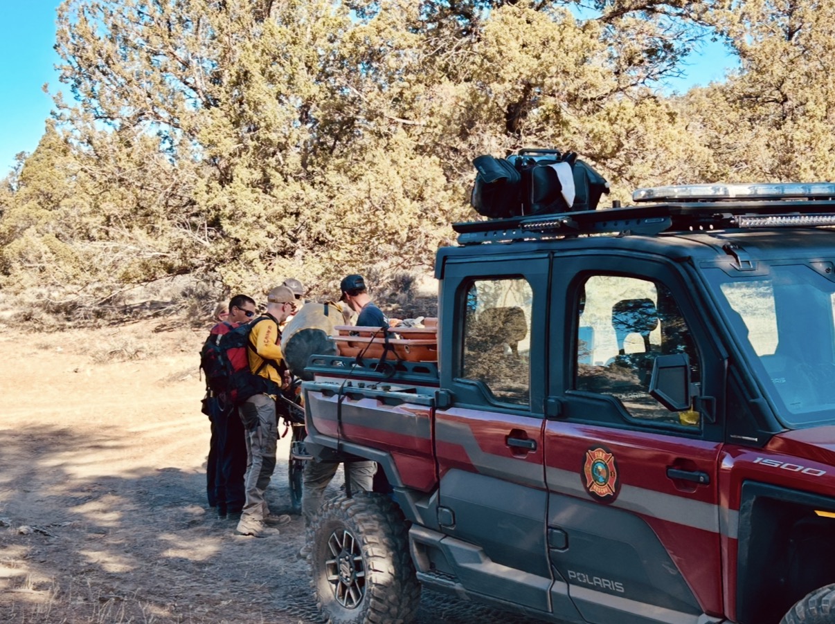
SAR volunteers and the deputy arrived shortly thereafter, assisted with medical evaluation, and transported the patient down the trail via wheeled litter without incident. She was transferred to Bend Fire at approximately 4:30 p.m. and taken to St. Charles-Bend for further care.


Green Lakes Trail – July 23, 2026

On July 23, 2026, at 1:38 p.m., Deschutes County 911 received a text‑to‑911 from an 18‑year‑old male near Green Lakes requesting assistance for a leg injury. Due to poor cell service, communication with the person was limited, and details of the injury were initially unclear.


A Deschutes County Sheriff’s Office Special Services Deputy and twelve SAR volunteers responded. SAR teams hiked approximately 4.5 miles from the Green Lakes Trailhead and located the injured hiker and his friend, both from Sunriver. It was later learned that the two had been descending Broken Top when one tripped and fell, resulting in the injury. SAR medical personnel evaluated the hiker and determined he could not walk out on his own.


The patient was transported on a wheeled litter back to the trailhead, where he was released to friends, who took him to St. Charles-Bend for further evaluation.


Safety Reminder

The Deschutes County Sheriff’s Office would like to remind those recreating outdoors to stay hydrated, carry ample water, tell friends or family where you're going, and take additional precautions when hiking during hot or smoky conditions. The Sheriff's Office thanks all of our SAR volunteers, Redmond Fire & Rescue, Bend Fire & Rescue, and Oregon State Parks staff for their assistance in these missions.


###


The Deschutes County Sheriff's Office Search & Rescue Volunteers Complete Back?to?Back Missions This Week (Photo) - 07/24/26


Deschutes County, Ore. -- The Deschutes County Sheriff’s Office Search and Rescue (SAR) volunteers responded to back‑to‑back missions this week, assisting injured and ill hikers in two separate areas of the county.


Misery Ridge, Smith Rock State Park – July 22, 2026

On July 22, 2026, at 1:46 p.m., a Deschutes County Sheriff’s Office Special Services Deputy was dispatched to Misery Ridge Trail at Smith Rock State Park for a report of a hiker who was dehydrated, not alert, and unable to safely descend the trail.


The patient, a 58‑year‑old woman from the San Francisco area, was reported to be about two‑thirds of the way up the trail. One Special Services Deputy and ten Deschutes County Sheriff’s Office Search and Rescue volunteers responded. Redmond Fire & Rescue, Bend Fire & Rescue, and a Smith Rock State Park Ranger also assisted. Bend Fire personnel and the park ranger reached the patient at approximately 2:40 p.m., providing initial care.


SAR volunteers and the deputy arrived shortly thereafter, assisted with medical evaluation, and transported the patient down the trail via wheeled litter without incident. She was transferred to Bend Fire at approximately 4:30 p.m. and taken to St. Charles-Bend for further care.


Green Lakes Trail – July 23, 2026

On July 23, 2026, at 1:38 p.m., Deschutes County 911 received a text‑to‑911 from an 18‑year‑old male near Green Lakes requesting assistance for a leg injury. Due to poor cell service, communication with the person was limited, and details of the injury were initially unclear.


A Deschutes County Sheriff’s Office Special Services Deputy and twelve SAR volunteers responded. SAR teams hiked approximately 4.5 miles from the Green Lakes Trailhead and located the injured hiker and his friend, both from Sunriver. It was later learned that the two had been descending Broken Top when one tripped and fell, resulting in the injury. SAR medical personnel evaluated the hiker and determined he could not walk out on his own.


The patient was transported on a wheeled litter back to the trailhead, where he was released to friends, who took him to St. Charles-Bend for further evaluation.


Safety Reminder

The Deschutes County Sheriff’s Office would like to remind those recreating outdoors to stay hydrated, carry ample water, tell friends or family where you're going, and take additional precautions when hiking during hot or smoky conditions. The Sheriff's Office thanks all of our SAR volunteers, Redmond Fire & Rescue, Bend Fire & Rescue, and Oregon State Parks staff for their assistance in these missions.


###


Akawa Butte Fire Update: The Deschutes County Sheriff's Office Announces Evacuation Levels Remain Unchanged For Friday, July 24 (Photo) - 07/24/26


Sisters, Ore. – The Deschutes County Sheriff’s Office and fire officials report that evacuation levels for the Akawa Butte Fire remain unchanged as of Friday, July 24. This stability is welcome news as crews continue to make progress on the fire under continued challenging conditions.


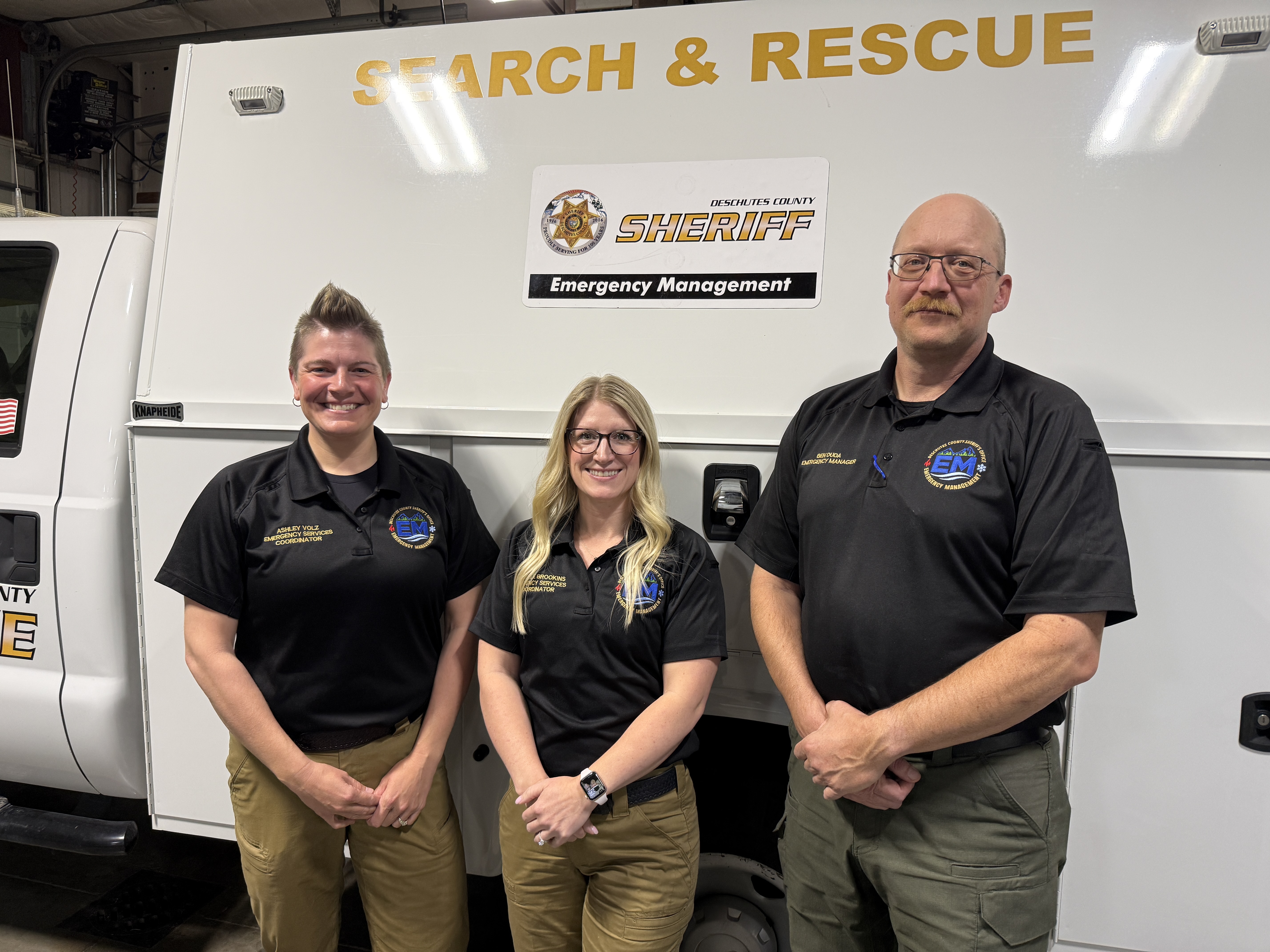
A Red Flag Warning is in effect, with windy afternoons expected over the next several days. These winds may create shifting fire behavior, and officials are asking the public to stay alert and be prepared for any potential changes. The Sheriff's Office Emergency Manager, Ben Duda, gave an update on evacuation notices at this morning's fire meeting and reminded residents to rely on official, real-time resources. Evacuation notices occur through deschutesalerts.org, and additional information with online maps can be found at: deschutes.org/emergency


The Sheriff’s Office will continue providing updates as conditions develop. Residents are encouraged to remain aware of changing weather and check official channels frequently.


ADDITIONAL RESOURCES

  • Akawa Fire information can be found at https://facebook.com/akawabuttefire
  • The Red Cross continues to support evacuees with a shelter at Sisters High School: 1700 W. McKinney Butte Rd.
  • For Pet OR Large Animal Evacuation: The Pet Evacuation Team is available to support animal-related evacuation needs. They can be reached at 541-610-6628.
  • For Large Animal Evacuation: Mustangs to the Rescue is available by call or text at 541-350-2406. An alternate number for Mustangs to the Rescue is 541-948-9535 (call or text).
  • Community members are encouraged to sign up for Deschutes Alerts to receive timely emergency notifications: https://deschutesalerts.org


###

Akawa Butte Fire Update: The Deschutes County Sheriff's Office Announces Evacuation Levels Remain Unchanged For Friday, July 24 (Photo) - 07/24/26


Sisters, Ore. – The Deschutes County Sheriff’s Office and fire officials report that evacuation levels for the Akawa Butte Fire remain unchanged as of Friday, July 24. This stability is welcome news as crews continue to make progress on the fire under continued challenging conditions.


A Red Flag Warning is in effect, with windy afternoons expected over the next several days. These winds may create shifting fire behavior, and officials are asking the public to stay alert and be prepared for any potential changes. The Sheriff's Office Emergency Manager, Ben Duda, gave an update on evacuation notices at this morning's fire meeting and reminded residents to rely on official, real-time resources. Evacuation notices occur through deschutesalerts.org, and additional information with online maps can be found at: deschutes.org/emergency


The Sheriff’s Office will continue providing updates as conditions develop. Residents are encouraged to remain aware of changing weather and check official channels frequently.


ADDITIONAL RESOURCES

  • Akawa Fire information can be found at https://facebook.com/akawabuttefire
  • The Red Cross continues to support evacuees with a shelter at Sisters High School: 1700 W. McKinney Butte Rd.
  • For Pet OR Large Animal Evacuation: The Pet Evacuation Team is available to support animal-related evacuation needs. They can be reached at 541-610-6628.
  • For Large Animal Evacuation: Mustangs to the Rescue is available by call or text at 541-350-2406. An alternate number for Mustangs to the Rescue is 541-948-9535 (call or text).
  • Community members are encouraged to sign up for Deschutes Alerts to receive timely emergency notifications: https://deschutesalerts.org


###

With Level 1 (Be Ready) Evacuation Notices Expanding In Sisters, The Deschutes County Sheriff’s Office Provides Guidance To Local Residents (Photo) - 07/23/26


Sisters, Ore. – The Deschutes County Sheriff’s Office recognizes that seeing your neighborhood placed in a Level 1 (Be Ready) evacuation zone can feel unsettling. The Sheriff’s Office wants to reassure residents that a Level 1 (Be Ready) is NOT a notice to leave. It simply means that public safety officials want you to be aware, prepared, and ready to act if conditions change.


A Level 1 (Be Ready) notice is issued early in the process to give you plenty of time to get organized. It does not indicate immediate danger.


Level 1 (Be Ready) means:

  • Stay alert to fire updates from official sources
  • Review your family’s emergency plan
  • Prepare a basic “go kit” with essentials like medications, important documents, and pet supplies
  • Make sure everyone in your household knows where to go if evacuation notices change

Fire activity is being closely monitored, and the Level 1 (Be Ready) designation helps ensure the community is ahead of any changes and provides the opportunity for people to prepare. Please know that wind and fire behavior can be erratic and move quickly. There can be times when a Level 3 (Go Now) is issued right away, or a Level 1 (Be Ready) is quickly upgraded to Level 2 (Get Set) or Level 3 (Go Now). Protecting lives is our number one priority, so evacuation notices are designed to keep people safe.


If conditions shift, any updates to evacuation levels will be communicated through Deschutes Alerts, the Sheriff's Office social media pages, and local media outlets. The Sheriff’s Office recommends people use the Genasys Protect Map for updated evacuation areas: deschutes.org/emergency or protect.genasys.com


ADDITIONAL RESOURCES

  • Deschutes Alerts: https://deschutesalerts.org/
  • Akawa Fire information can be found at https://facebook.com/akawabuttefire
  • The Red Cross continues to support evacuees with a shelter at Sisters High School: 1700 W. McKinney Butte Rd.
  • For Pet OR Large Animal Evacuation:
  • The Pet Evacuation Team is available to support animal-related evacuation needs. They can be reached at 541-610-6628.
  • For Large Animal Evacuation
  • Mustangs to the Rescue is available by call or text at 541-350-2406. An alternate number for Mustangs to the Rescue is 541-948-9535 (call or text).

###


Attached Media Files: ReadySetGo.png, EvacLevelsOEM.jpg,

With Level 1 (Be Ready) Evacuation Notices Expanding In Sisters, The Deschutes County Sheriff’s Office Provides Guidance To Local Residents (Photo) - 07/23/26


Sisters, Ore. – The Deschutes County Sheriff’s Office recognizes that seeing your neighborhood placed in a Level 1 (Be Ready) evacuation zone can feel unsettling. The Sheriff’s Office wants to reassure residents that a Level 1 (Be Ready) is NOT a notice to leave. It simply means that public safety officials want you to be aware, prepared, and ready to act if conditions change.


A Level 1 (Be Ready) notice is issued early in the process to give you plenty of time to get organized. It does not indicate immediate danger.


Level 1 (Be Ready) means:

  • Stay alert to fire updates from official sources
  • Review your family’s emergency plan
  • Prepare a basic “go kit” with essentials like medications, important documents, and pet supplies
  • Make sure everyone in your household knows where to go if evacuation notices change

Fire activity is being closely monitored, and the Level 1 (Be Ready) designation helps ensure the community is ahead of any changes and provides the opportunity for people to prepare. Please know that wind and fire behavior can be erratic and move quickly. There can be times when a Level 3 (Go Now) is issued right away, or a Level 1 (Be Ready) is quickly upgraded to Level 2 (Get Set) or Level 3 (Go Now). Protecting lives is our number one priority, so evacuation notices are designed to keep people safe.


If conditions shift, any updates to evacuation levels will be communicated through Deschutes Alerts, the Sheriff's Office social media pages, and local media outlets. The Sheriff’s Office recommends people use the Genasys Protect Map for updated evacuation areas: deschutes.org/emergency or protect.genasys.com


ADDITIONAL RESOURCES

  • Deschutes Alerts: https://deschutesalerts.org/
  • Akawa Fire information can be found at https://facebook.com/akawabuttefire
  • The Red Cross continues to support evacuees with a shelter at Sisters High School: 1700 W. McKinney Butte Rd.
  • For Pet OR Large Animal Evacuation:
  • The Pet Evacuation Team is available to support animal-related evacuation needs. They can be reached at 541-610-6628.
  • For Large Animal Evacuation
  • Mustangs to the Rescue is available by call or text at 541-350-2406. An alternate number for Mustangs to the Rescue is 541-948-9535 (call or text).

###


Attached Media Files: ReadySetGo.png, EvacLevelsOEM.jpg,

The Deschutes County Sheriff’s Offices Issues New Akawa Butte Fire Evacuation Notices As Changing Conditions Persist Despite Wednesday’s Rain (Photo) - 07/23/26

***UPDATE: July 23, 11:50 a.m.****


The Deschutes County Sheriff's Office confirms that one residence has been lost to the Akawa Butte Fire in the Stevens Canyon area, located Northeast of Sisters. 


Deschutes County, Ore. -- Fire officials and the Deschutes County Sheriff’s Office have adjusted more evacuation areas due to the Akawa Butte Fire, including new Level 2 (Be Set) and new Level 1 (Be Ready) as of 11:00 a.m. on Thursday, July 23rd. Even with the precipitation yesterday, expected hot, dry, and breezy conditions create conditions that warrant expanded evacuation notices.


Please understand that conditions can change rapidly, and stay alert to changing conditions. The Sheriff’s Office recommends people use the Genasys Protect Map for updated evacuation areas: deschutes.org/emergency or protect.genasys.com


THESE ARE THE CURRENT EVACUATION NOTICES AS OF THURSDAY, JULY 23, 11:00AM:


Road Closures Still in Effect:

  • Wilt Road eastbound from Camp Polk Road
  • Camp Polk northbound from Crooked Horseshoe to Wilt Road
  • Indian Ford Road between Camp Polk Road and FS 11


New Level 3 (Go Now) evacuation notices:

  • Areas between Indian Ford Creek and Camp Polk Road and Indian Ford Road from the 69600 Block of Camp Polk Road north to North Pine Street.
  • Squaw Creek Canyon Estates to include areas off Mt. View Road between Appaloosa Drive and Buffalo Drive
  • Henkle Butte area, Vista Ridge Drive, Stardust Lane, and Annie’s Drive
  • Area surrounding Camp Polk Cemetery
  • Fair Mile Road south of Wilt Road, including Suntree Lane
  • Area of Old Wagon Road, West Meadow Parkway, and Tumbleweed Turn
  • Meadow View Road area between Indian Ford Road and Indian Ford Creek
  • Northern end of Mt. View Road
  • Wilt Road north of Buffalo Drive to Big Buck Road
  • USFS lands north of Cascade Meadows Ranch to Indian Ford Creek and west of North Pine Street, including the Zimmerman Butte area.
  • Freemont Canyon area east of Wilt Road and north of Big Buck Road, to include Rimrock Ranch
  • Pine Ridge Road and Fox Ridge Circle off of Indian Ford Road
  • Forest land (USFS and private) east of Stevens Canyon Road and south of a line from Stevens Canyon Road and FS 2050/390 spur, east approximately 4 miles to the National Forest Boundary, and South to Wilt Rd. Commonly referred to as the southern portion of Sage Flat. Excluding Fox Ridge Circle and Pine Ridge Road
  • Private property on both sides of the northern portion of Indian Ford Road north of Indian Ford Creek to the Forest Boundary.


DOWNGRADING FROM Level 3 (Go Now) to Level 2 (Be Set)

  • Cascade Meadow Ranch and Windigo Trail Road


New Level 2 (Be Set) evacuation notices:

  • Cascade Meadow Ranch and Windigo Trail Road
  • National Forest areas north of Sisters and south of Cascade Meadow Ranch
  • Areas North of Sisters, including Trapper Point, Crooked Horseshoe, & Sage Meadow
  • West of Camp Polk Rd. And north of the Sisters airport, including Pilot Drive and Kittyhawk Ln. 
  • Areas Northeast of Sisters, including Upper and Lower Cattle Dr, Old Juniper Rd & Deer Ridge Rd.
  • Old Military Drive
  • – Area between Whychus Creek and Panoramic Estates, including the north end of Lake Drive
  • North side of Goodrich Road up to Whychus Creek, including Goodrich Lane and Whychus Canyon Preserve
  • Lower Holmes Road area, north of milepost 5 to Lower Bridge Road


New Level 1 (Be Ready) evacuation notices:

  • West of Highway 20 and East of Black Butte Ranch, Glaze Meadow Area
  • National Forest area between the Brooks-Scanlon Logging Road and Highway 20, north of Tollgate Subdivision, south of FS Road 1012.
  • Tollgate Subdivision
  • West Sisters, including Sisters High School, Sisters Middle School, McKenzie Meadows & area south of Tollgate
  • West Sisters, including the commercial area and the Village at Cold Springs, The Pines at Sisters & the East Portal Interpretive Site
  • North Sisters, including part of downtown, the industrial park, Sun Ranch, and Clear Pine
  • Areas Northeast of Sisters, including the airport & Barclay Meadows
  • East Sisters, including areas East of Locust Street and Timber Creek 
  • Areas East of Sisters between Whychus Creek and Hwy 126
  • Areas Northeast of Sisters, including McKinney Butte & Wild Horse Ridge
  • East of Sisters Between Whychus Creek & Camp Polk Rd, North of Hwy 126, including Junipine Ln, Bradley Rd & Hawks Flight Dr 
  • Aspen Lakes
  • Panoramic Estates, and Emerald Valley Rd/Sisters View Dr
  • Both sides of Edmundson Rd between Goodrich Rd and Holmes Rd, Northern Cloverdale area
  • Both sides of Holmes Road from milepost 2.5 to milepost 5, including Wanona Road, Gold Coach Road, and McSwain Drive
  • Lower Holmes Road area north of milepost 5 to Lower Bridge Rd


EVACUTION NOTICE LEVELS

  • Level 3 means GO NOW! Residents in this area should leave immediately. Do not take time to gather belongings or attempt to protect property. Drive carefully, use headlights, and follow traffic safety instructions. Do not return until officials announce it is safe.
  • Level 2 BE SET means residents should be prepared to evacuate at a moment’s notice. Conditions may change quickly, and residents should stay alert and keep essential items ready.
  • Level 1 BE READY means residents should remain aware of the fire situation and be prepared if evacuation levels increase.


ADDITIONAL RESOURCES

  • The Red Cross continues to support evacuees with a shelter at Sisters High School: 1700 W. McKinney Butte Rd.
  • For Pet OR Large Animal Evacuation:
    • The Pet Evacuation Team is available to support animal-related evacuation needs. They can be reached at 541-610-6628.
  • For Large Animal Evacuation
    • Mustangs to the Rescue is available by call or text at 541-350-2406. An alternate number for Mustangs to the Rescue is 541-948-9535 (call or text).


###


Attached Media Files: AkawaButteFireUpdateJuly23.png,

The Deschutes County Sheriff’s Offices Issues New Akawa Butte Fire Evacuation Notices As Changing Conditions Persist Despite Wednesday’s Rain (Photo) - 07/23/26

***UPDATE: July 23, 11:50 a.m.****


The Deschutes County Sheriff's Office confirms that one residence has been lost to the Akawa Butte Fire in the Stevens Canyon area, located Northeast of Sisters. 


Deschutes County, Ore. -- Fire officials and the Deschutes County Sheriff’s Office have adjusted more evacuation areas due to the Akawa Butte Fire, including new Level 2 (Be Set) and new Level 1 (Be Ready) as of 11:00 a.m. on Thursday, July 23rd. Even with the precipitation yesterday, expected hot, dry, and breezy conditions create conditions that warrant expanded evacuation notices.


Please understand that conditions can change rapidly, and stay alert to changing conditions. The Sheriff’s Office recommends people use the Genasys Protect Map for updated evacuation areas: deschutes.org/emergency or protect.genasys.com


THESE ARE THE CURRENT EVACUATION NOTICES AS OF THURSDAY, JULY 23, 11:00AM:


Road Closures Still in Effect:

  • Wilt Road eastbound from Camp Polk Road
  • Camp Polk northbound from Crooked Horseshoe to Wilt Road
  • Indian Ford Road between Camp Polk Road and FS 11


New Level 3 (Go Now) evacuation notices:

  • Areas between Indian Ford Creek and Camp Polk Road and Indian Ford Road from the 69600 Block of Camp Polk Road north to North Pine Street.
  • Squaw Creek Canyon Estates to include areas off Mt. View Road between Appaloosa Drive and Buffalo Drive
  • Henkle Butte area, Vista Ridge Drive, Stardust Lane, and Annie’s Drive
  • Area surrounding Camp Polk Cemetery
  • Fair Mile Road south of Wilt Road, including Suntree Lane
  • Area of Old Wagon Road, West Meadow Parkway, and Tumbleweed Turn
  • Meadow View Road area between Indian Ford Road and Indian Ford Creek
  • Northern end of Mt. View Road
  • Wilt Road north of Buffalo Drive to Big Buck Road
  • USFS lands north of Cascade Meadows Ranch to Indian Ford Creek and west of North Pine Street, including the Zimmerman Butte area.
  • Freemont Canyon area east of Wilt Road and north of Big Buck Road, to include Rimrock Ranch
  • Pine Ridge Road and Fox Ridge Circle off of Indian Ford Road
  • Forest land (USFS and private) east of Stevens Canyon Road and south of a line from Stevens Canyon Road and FS 2050/390 spur, east approximately 4 miles to the National Forest Boundary, and South to Wilt Rd. Commonly referred to as the southern portion of Sage Flat. Excluding Fox Ridge Circle and Pine Ridge Road
  • Private property on both sides of the northern portion of Indian Ford Road north of Indian Ford Creek to the Forest Boundary.


DOWNGRADING FROM Level 3 (Go Now) to Level 2 (Be Set)

  • Cascade Meadow Ranch and Windigo Trail Road


New Level 2 (Be Set) evacuation notices:

  • Cascade Meadow Ranch and Windigo Trail Road
  • National Forest areas north of Sisters and south of Cascade Meadow Ranch
  • Areas North of Sisters, including Trapper Point, Crooked Horseshoe, & Sage Meadow
  • West of Camp Polk Rd. And north of the Sisters airport, including Pilot Drive and Kittyhawk Ln. 
  • Areas Northeast of Sisters, including Upper and Lower Cattle Dr, Old Juniper Rd & Deer Ridge Rd.
  • Old Military Drive
  • – Area between Whychus Creek and Panoramic Estates, including the north end of Lake Drive
  • North side of Goodrich Road up to Whychus Creek, including Goodrich Lane and Whychus Canyon Preserve
  • Lower Holmes Road area, north of milepost 5 to Lower Bridge Road


New Level 1 (Be Ready) evacuation notices:

  • West of Highway 20 and East of Black Butte Ranch, Glaze Meadow Area
  • National Forest area between the Brooks-Scanlon Logging Road and Highway 20, north of Tollgate Subdivision, south of FS Road 1012.
  • Tollgate Subdivision
  • West Sisters, including Sisters High School, Sisters Middle School, McKenzie Meadows & area south of Tollgate
  • West Sisters, including the commercial area and the Village at Cold Springs, The Pines at Sisters & the East Portal Interpretive Site
  • North Sisters, including part of downtown, the industrial park, Sun Ranch, and Clear Pine
  • Areas Northeast of Sisters, including the airport & Barclay Meadows
  • East Sisters, including areas East of Locust Street and Timber Creek 
  • Areas East of Sisters between Whychus Creek and Hwy 126
  • Areas Northeast of Sisters, including McKinney Butte & Wild Horse Ridge
  • East of Sisters Between Whychus Creek & Camp Polk Rd, North of Hwy 126, including Junipine Ln, Bradley Rd & Hawks Flight Dr 
  • Aspen Lakes
  • Panoramic Estates, and Emerald Valley Rd/Sisters View Dr
  • Both sides of Edmundson Rd between Goodrich Rd and Holmes Rd, Northern Cloverdale area
  • Both sides of Holmes Road from milepost 2.5 to milepost 5, including Wanona Road, Gold Coach Road, and McSwain Drive
  • Lower Holmes Road area north of milepost 5 to Lower Bridge Rd


EVACUTION NOTICE LEVELS

  • Level 3 means GO NOW! Residents in this area should leave immediately. Do not take time to gather belongings or attempt to protect property. Drive carefully, use headlights, and follow traffic safety instructions. Do not return until officials announce it is safe.
  • Level 2 BE SET means residents should be prepared to evacuate at a moment’s notice. Conditions may change quickly, and residents should stay alert and keep essential items ready.
  • Level 1 BE READY means residents should remain aware of the fire situation and be prepared if evacuation levels increase.


ADDITIONAL RESOURCES

  • The Red Cross continues to support evacuees with a shelter at Sisters High School: 1700 W. McKinney Butte Rd.
  • For Pet OR Large Animal Evacuation:
    • The Pet Evacuation Team is available to support animal-related evacuation needs. They can be reached at 541-610-6628.
  • For Large Animal Evacuation
    • Mustangs to the Rescue is available by call or text at 541-350-2406. An alternate number for Mustangs to the Rescue is 541-948-9535 (call or text).


###


Attached Media Files: AkawaButteFireUpdateJuly23.png,

Afternoon Thunderstorms And Windy Conditions Prompt More Level 3 (Go Now) Evacuation Notices For Akawa Butte Fire - 07/22/26


Deschutes County, Ore. -- Fire officials and the Deschutes County Sheriff’s Office have elevated more areas of the Akawa Butte Fire to Level 3 (Go Now) as of 4:00 p.m. on Wednesday, July 22. New zones have also been added to Level 1 (Be Ready) as hot and windy conditions continue pushing fire activity in various directions. Fire officials on the ground say current thunderstorms are causing violent shifts in wind and fire direction. The fire was pushing south toward Sisters, but is now moving east.  


With conditions changing rapidly, the Sheriff’s Office recommends people use the Genasys Protect Map for updated evacuation areas: deschutes.org/emergency or protect.genasys.com


THESE ARE CURRENT AS OF WEDNESDAY, JULY 22ND / 4:00 PM:


Road Closures Still in Effect:

  • Indian Ford Road between Hwy 20 and Meadow View Lane
  • Wilt Road north of Buffalo Drive
  • Wilt Road at Camp Polk
  • Camp Polk at Crooked Horseshoe


UPDATED EVACUATION ZONES HIGHLIGHTED IN RED


New Level 3 (Go Now) evacuation notices:

  • Areas between Indian Ford Creek and Camp Polk Road and Indian Ford Road from the 69600 Block of Camp Polk Road north to North Pine Street.
  • Squaw Creek Canyon Estates to include areas off Mt. View Road between Appaloosa Drive and Buffalo Drive
  • Henkle Butte area, Vista Ridge Drive, Stardust Lane, and Annie’s Drive
  • Area surrounding Camp Polk Cemetery
  • Fair Mile Road south of Wilt Road, including Suntree Lane
  • Area of Old Wagon Road, West Meadow Parkway, and Tumbleweed Turn
  • Cascade Meadow Ranch to include Windigo Trail Road
  • Meadow View Road area between Indian Ford Road and Indian Ford Creek
  • Northern end of Mt. View Road
  • Wilt Road north of Buffalo Drive to Big Buck Road
  • USFS lands north of Cascade Meadows Ranch to Indian Ford Creek and west of North Pine Street, including the Zimmerman Butte area.
  • Freemont Canyon area east of Wilt Road and north of Big Buck Road, to include Rimrock Ranch
  • Pine Ridge Road and Fox Ridge Circle off of Indian Ford Road
  • Forest land (USFS and private) east of Stevens Canyon Road and south of a line from Stevens Canyon Road and FS 2050/390 spur, east approximately 4 miles to the National Forest Boundary, and South to Wilt Rd. Commonly referred to as the southern portion of Sage Flat. Excluding Fox Ridge Circle and Pine Ridge Road
  • Private property on both sides of the northern portion of Indian Ford Road north of Indian Ford Creek to the Forest Boundary.


New Level 2 (Be Set) evacuation notices:

  • No zones currently in Level 2 (Be Set)


New Level 1 (Be Ready) evacuation notices:

  • South of Forest Service Road 600, east of Hwy 20, west of Pine Street, also known as Forest Service Road-2058, and north of Forest Service Road 100.
  • Area of Trapper Point Road and Crooked Horseshoe Road
  • Deer Ridge Road, Foothill Lane and Foothill Loop, and Big View Drive
  • The Hill Subdivision, Old Juniper Road, Cattle Drive, Sundown, Lower Cattle Drive and Omaha Drive.
  • USFS lands north of Hwy 20, west of FS Road 11, and south of the Deschutes/Jefferson County line.


EVACUTION NOTICE LEVELS

  • Level 3 means GO NOW! Residents in this area should leave immediately. Do not take time to gather belongings or attempt to protect property. Drive carefully, use headlights, and follow traffic safety instructions. Do not return until officials announce it is safe.
  • Level 2 BE SET means residents should be prepared to evacuate at a moment’s notice. Conditions may change quickly, and residents should stay alert and keep essential items ready.
  • Level 1 BE READY means residents should remain aware of the fire situation and be prepared if evacuation levels increase.


ADDITIONAL RESOURCES

  • The Red Cross continues to support evacuees with a shelter at Sisters High School: 1700 W. McKinney Butte Rd.
  • For Pet OR Large Animal Evacuation:
    • The Pet Evacuation Team is available to support animal-related evacuation needs. They can be reached at 541-610-6628.
  • For Large Animal Evacuation
    • Mustangs to the Rescue is available by call or text at 541-350-2406. An alternate number for Mustangs to the Rescue is 541-948-9535 (call or text).


###


Afternoon Thunderstorms And Windy Conditions Prompt More Level 3 (Go Now) Evacuation Notices For Akawa Butte Fire - 07/22/26


Deschutes County, Ore. -- Fire officials and the Deschutes County Sheriff’s Office have elevated more areas of the Akawa Butte Fire to Level 3 (Go Now) as of 4:00 p.m. on Wednesday, July 22. New zones have also been added to Level 1 (Be Ready) as hot and windy conditions continue pushing fire activity in various directions. Fire officials on the ground say current thunderstorms are causing violent shifts in wind and fire direction. The fire was pushing south toward Sisters, but is now moving east.  


With conditions changing rapidly, the Sheriff’s Office recommends people use the Genasys Protect Map for updated evacuation areas: deschutes.org/emergency or protect.genasys.com


THESE ARE CURRENT AS OF WEDNESDAY, JULY 22ND / 4:00 PM:


Road Closures Still in Effect:

  • Indian Ford Road between Hwy 20 and Meadow View Lane
  • Wilt Road north of Buffalo Drive
  • Wilt Road at Camp Polk
  • Camp Polk at Crooked Horseshoe


UPDATED EVACUATION ZONES HIGHLIGHTED IN RED


New Level 3 (Go Now) evacuation notices:

  • Areas between Indian Ford Creek and Camp Polk Road and Indian Ford Road from the 69600 Block of Camp Polk Road north to North Pine Street.
  • Squaw Creek Canyon Estates to include areas off Mt. View Road between Appaloosa Drive and Buffalo Drive
  • Henkle Butte area, Vista Ridge Drive, Stardust Lane, and Annie’s Drive
  • Area surrounding Camp Polk Cemetery
  • Fair Mile Road south of Wilt Road, including Suntree Lane
  • Area of Old Wagon Road, West Meadow Parkway, and Tumbleweed Turn
  • Cascade Meadow Ranch to include Windigo Trail Road
  • Meadow View Road area between Indian Ford Road and Indian Ford Creek
  • Northern end of Mt. View Road
  • Wilt Road north of Buffalo Drive to Big Buck Road
  • USFS lands north of Cascade Meadows Ranch to Indian Ford Creek and west of North Pine Street, including the Zimmerman Butte area.
  • Freemont Canyon area east of Wilt Road and north of Big Buck Road, to include Rimrock Ranch
  • Pine Ridge Road and Fox Ridge Circle off of Indian Ford Road
  • Forest land (USFS and private) east of Stevens Canyon Road and south of a line from Stevens Canyon Road and FS 2050/390 spur, east approximately 4 miles to the National Forest Boundary, and South to Wilt Rd. Commonly referred to as the southern portion of Sage Flat. Excluding Fox Ridge Circle and Pine Ridge Road
  • Private property on both sides of the northern portion of Indian Ford Road north of Indian Ford Creek to the Forest Boundary.


New Level 2 (Be Set) evacuation notices:

  • No zones currently in Level 2 (Be Set)


New Level 1 (Be Ready) evacuation notices:

  • South of Forest Service Road 600, east of Hwy 20, west of Pine Street, also known as Forest Service Road-2058, and north of Forest Service Road 100.
  • Area of Trapper Point Road and Crooked Horseshoe Road
  • Deer Ridge Road, Foothill Lane and Foothill Loop, and Big View Drive
  • The Hill Subdivision, Old Juniper Road, Cattle Drive, Sundown, Lower Cattle Drive and Omaha Drive.
  • USFS lands north of Hwy 20, west of FS Road 11, and south of the Deschutes/Jefferson County line.


EVACUTION NOTICE LEVELS

  • Level 3 means GO NOW! Residents in this area should leave immediately. Do not take time to gather belongings or attempt to protect property. Drive carefully, use headlights, and follow traffic safety instructions. Do not return until officials announce it is safe.
  • Level 2 BE SET means residents should be prepared to evacuate at a moment’s notice. Conditions may change quickly, and residents should stay alert and keep essential items ready.
  • Level 1 BE READY means residents should remain aware of the fire situation and be prepared if evacuation levels increase.


ADDITIONAL RESOURCES

  • The Red Cross continues to support evacuees with a shelter at Sisters High School: 1700 W. McKinney Butte Rd.
  • For Pet OR Large Animal Evacuation:
    • The Pet Evacuation Team is available to support animal-related evacuation needs. They can be reached at 541-610-6628.
  • For Large Animal Evacuation
    • Mustangs to the Rescue is available by call or text at 541-350-2406. An alternate number for Mustangs to the Rescue is 541-948-9535 (call or text).


###


Akawa Butte Fire Update: The Deschutes County Sheriff’s Office Closes Two Roads As Evacuation Notices Increase (Photo) - 07/22/26


Deschutes County, Ore. -- Fire officials and the Deschutes County Sheriff’s Office have added new evacuation areas for the Akawa Butte Fire as of 12:00 p.m. on Wednesday, July 22, and announced two road closures. Fire activity continued to shift to the South and Southwest throughout the night. The changes to evacuation levels include Forest Service land and private property north of the City of Sisters and generally in the area of Indian Ford Road, Camp Polk Road, and Wilt Road.  


These are current as of Wednesday, July 22nd / 12 PM:


Road Closures:

  • Indian Ford Road between Hwy 20 and Meadow View Lane
  • Wilt Road north of Buffalo Drive


New Level 3 (Go Now) evacuation notices:

  • Forest land (USFS and private) east of Stevens Canyon Road and south of a line from Stevens Canyon Road and FS 2050/390 spur, east approximately 4 miles to the National Forest Boundary, and South to Wilt Rd. Commonly referred to as the southern portion of Sage Flat. Excluding Fox Ridge Circle and Pine Ridge Road
  • Private property on both sides of the northern portion of Indian Ford Road north of Indian Ford Creek to the Forest Boundary.


New Level 2 (Be Set) evacuation notices:

  • Pine Ridge Road and Fox Ridge Circle off of Indian Ford Road
  • Wilt Road north of Buffalo Drive to Big Buck Road.
  • Northern single-lane section of Mountain View Road
  • Areas between Indian Ford Creek and Camp Polk Road and Indian Ford Road from the 69600 Block of Camp Polk Road north to North Pine Street.
  • USFS lands north of Cascade Meadows Ranch to Indian Ford Creek and west of North Pine Street, including the Zimmerman Butte area.


New Level 1 (Be Ready) evacuation notices:

  • Areas between Wilt Road and Whychus Creek from Camp Polk Road north to the 17700 Block of Mountain View Road, including Whychus Canyon Estates, Henkle Butte, and Sno Cap Vista.
  • Areas between North Pine Street and Indian Ford Creek north of Lundy Road, including the Sage Meadow areas.
  • The Hill Subdivision, Old Juniper Rd, Cattle Dr, Sundown, Lower Cattle Dr, and Omaha Drive.
  • USFS lands north of Hwy 20, west of FS Road 11, and south of the Deschutes/Jefferson County line.
  • Cascade Meadow Estates


EVACUTION NOTICE LEVELS

  • Level 3 means GO NOW! Residents in this area should leave immediately. Do not take time to gather belongings or attempt to protect property. Drive carefully, use headlights, and follow traffic safety instructions. Do not return until officials announce it is safe.
  • Level 2 BE SET means residents should be prepared to evacuate at a moment’s notice. Conditions may change quickly, and residents should stay alert and keep essential items ready.
  • Level 1 BE READY means residents should remain aware of the fire situation and be prepared if evacuation levels increase.


ADDITIONAL RESOURCES

###


Attached Media Files: AkawaFireEvacMapJuly22.png,

Akawa Butte Fire Update: The Deschutes County Sheriff’s Office Closes Two Roads As Evacuation Notices Increase (Photo) - 07/22/26


Deschutes County, Ore. -- Fire officials and the Deschutes County Sheriff’s Office have added new evacuation areas for the Akawa Butte Fire as of 12:00 p.m. on Wednesday, July 22, and announced two road closures. Fire activity continued to shift to the South and Southwest throughout the night. The changes to evacuation levels include Forest Service land and private property north of the City of Sisters and generally in the area of Indian Ford Road, Camp Polk Road, and Wilt Road.  


These are current as of Wednesday, July 22nd / 12 PM:


Road Closures:

  • Indian Ford Road between Hwy 20 and Meadow View Lane
  • Wilt Road north of Buffalo Drive


New Level 3 (Go Now) evacuation notices:

  • Forest land (USFS and private) east of Stevens Canyon Road and south of a line from Stevens Canyon Road and FS 2050/390 spur, east approximately 4 miles to the National Forest Boundary, and South to Wilt Rd. Commonly referred to as the southern portion of Sage Flat. Excluding Fox Ridge Circle and Pine Ridge Road
  • Private property on both sides of the northern portion of Indian Ford Road north of Indian Ford Creek to the Forest Boundary.


New Level 2 (Be Set) evacuation notices:

  • Pine Ridge Road and Fox Ridge Circle off of Indian Ford Road
  • Wilt Road north of Buffalo Drive to Big Buck Road.
  • Northern single-lane section of Mountain View Road
  • Areas between Indian Ford Creek and Camp Polk Road and Indian Ford Road from the 69600 Block of Camp Polk Road north to North Pine Street.
  • USFS lands north of Cascade Meadows Ranch to Indian Ford Creek and west of North Pine Street, including the Zimmerman Butte area.


New Level 1 (Be Ready) evacuation notices:

  • Areas between Wilt Road and Whychus Creek from Camp Polk Road north to the 17700 Block of Mountain View Road, including Whychus Canyon Estates, Henkle Butte, and Sno Cap Vista.
  • Areas between North Pine Street and Indian Ford Creek north of Lundy Road, including the Sage Meadow areas.
  • The Hill Subdivision, Old Juniper Rd, Cattle Dr, Sundown, Lower Cattle Dr, and Omaha Drive.
  • USFS lands north of Hwy 20, west of FS Road 11, and south of the Deschutes/Jefferson County line.
  • Cascade Meadow Estates


EVACUTION NOTICE LEVELS

  • Level 3 means GO NOW! Residents in this area should leave immediately. Do not take time to gather belongings or attempt to protect property. Drive carefully, use headlights, and follow traffic safety instructions. Do not return until officials announce it is safe.
  • Level 2 BE SET means residents should be prepared to evacuate at a moment’s notice. Conditions may change quickly, and residents should stay alert and keep essential items ready.
  • Level 1 BE READY means residents should remain aware of the fire situation and be prepared if evacuation levels increase.


ADDITIONAL RESOURCES

###


Attached Media Files: AkawaFireEvacMapJuly22.png,

Akawa Butte Fire Update: Shifting Conditions Prompt New Evacuation Levels From The Deschutes County Sheriff’s Office - 07/21/26


***EVACUATION LEVEL UPDATE AS OF 8:00 P.M., TUESDAY, JULY 21***


The following area that was previously under a Level 1 (Be Ready) Evacuation Notice has been upgraded to a Level 2 (Be Set) Evacuation Notice:

  • Private property on the north of Indian Ford Creek to the Forest Boundary. This area has been upgraded to a Level 2 (Be Set) Evacuation Notice. 


Deschutes County, Ore. -- As of 5:00 p.m. on Tuesday, July 21, fire officials and the Deschutes County Sheriff’s Office have added new evacuation areas for the Akawa Butte Fire. Weather conditions continued to shift the fire to the Southwest throughout the day. The changes to evacuation levels include Forest Service land and private property north of the City of Sisters and generally in the area of Indian Ford Road, Camp Polk Road, and Wilt Road.  


These are current as of Tuesday, July 21st / 5 PM:


New Level 3 (Go Now) evacuation notices:

  • Forest lands (USFS and private) east of FS Road 2050, approximately 4 miles to the National Forest Boundary. Commonly referred to as the northern portion of Sage Flat and the southern portion of Stevens Canyon.

New Level 2 (Be Set) evacuation notices:

  • Forest land (USFS and private) east of Stevens Canyon Road and south of a line from Stevens Canyon Road and FS 2050/390 spur, east approximately 4 miles to the National Forest Boundary, and South to Wilt Rd. Commonly referred to as the southern portion of Sage Flat.
  • Private property on the north of Indian Ford Creek Road to the Forest Boundary.

New Level 1 (Be Ready) evacuation notices:

  • Areas between Indian Ford Creek and Camp Polk Road and Indian Ford Road from the 69600 Block of Camp Polk Road north to Hwy 20.


EXISTING EVACUATION NOTICES


Level 3 (Go Now)

The following area is now at Level 3 (Go Now):

  • Northern part of Stevens Canyon Road between Forest Road 2050 and west of Wilt Road north of Big Buck Road.
  • Forest lands (USFS and private) east of FS Road 2050, approximately 4 miles to the National Forest Boundary. Commonly referred to as the northern portion of Sage Flat and the southern portion of Stevens Canyon


Level 3 means GO NOW! Residents in this area should leave immediately. Do not take time to gather belongings or attempt to protect property. Drive carefully, use headlights, and follow traffic safety instructions. Do not return until officials announce it is safe.


Level 2 (Be Set)

The following area is now at Level 2 (Be Set):

  • Addresses on the east side of Wilt Road, north of Big Buck Road to the county line.
  • Forest land (USFS and private) east of Stevens Canyon Road and south of a line from Stevens Canyon Road and FS 2050/390 spur east approximately 4 miles to the National Forest Boundary and South to Wilt Rd. Commonly referred to as the southern portion of Sage Flat.
  • Forest Service lands west of FS 2052 to the FS 11 and north of private property off Indian Ford Rd.


Level 2 BE SET means residents should be prepared to evacuate at a moment’s notice. Conditions may change quickly, and residents should stay alert and keep essential items ready.


Level 1 (Be Ready)

Previously Issued and Still in Effect. Existing Level 1 areas include:

  • Wilt Road north of Buffalo Drive to Big Buck Rd.
  • Northern single lane section of Mountain View Road
  • Pine Ridge Rd and Fox Ridge Circle off of Indian Ford Road
  • Areas between Indian Ford Creek and Camp Polk Road and Indian Ford Road from the 69600 Block of Camp Polk Road north to Hwy 20.
  • Private property on the north of Indian Ford Road to the Forest Boundary.


Level 1 BE READY means residents should remain aware of the fire situation and be prepared if evacuation levels increase.


Akawa Fire information can be found at https://facebook.com/akawabuttefire


Additional Resources:

  • The Red Cross continues to support evacuees with a shelter at Sisters High School: 1700 W. McKinney Butte Rd.
  • The Pet Evacuation Team is available to support animal-related evacuation needs. They can be reached at 541-610-6628.
  • Community members are encouraged to sign up for Deschutes Alerts to receive timely emergency notifications: https://deschutesalerts.org
  • For a live map of evacuation areas, visit deschutes.org/emergency or protect.genasys.com
  • For additional fire information and regional updates, visit: https://centraloregonfire.org


Akawa Butte Fire Update: Shifting Conditions Prompt New Evacuation Levels From The Deschutes County Sheriff’s Office - 07/21/26


***EVACUATION LEVEL UPDATE AS OF 8:00 P.M., TUESDAY, JULY 21***


The following area that was previously under a Level 1 (Be Ready) Evacuation Notice has been upgraded to a Level 2 (Be Set) Evacuation Notice:

  • Private property on the north of Indian Ford Creek to the Forest Boundary. This area has been upgraded to a Level 2 (Be Set) Evacuation Notice. 


Deschutes County, Ore. -- As of 5:00 p.m. on Tuesday, July 21, fire officials and the Deschutes County Sheriff’s Office have added new evacuation areas for the Akawa Butte Fire. Weather conditions continued to shift the fire to the Southwest throughout the day. The changes to evacuation levels include Forest Service land and private property north of the City of Sisters and generally in the area of Indian Ford Road, Camp Polk Road, and Wilt Road.  


These are current as of Tuesday, July 21st / 5 PM:


New Level 3 (Go Now) evacuation notices:

  • Forest lands (USFS and private) east of FS Road 2050, approximately 4 miles to the National Forest Boundary. Commonly referred to as the northern portion of Sage Flat and the southern portion of Stevens Canyon.

New Level 2 (Be Set) evacuation notices:

  • Forest land (USFS and private) east of Stevens Canyon Road and south of a line from Stevens Canyon Road and FS 2050/390 spur, east approximately 4 miles to the National Forest Boundary, and South to Wilt Rd. Commonly referred to as the southern portion of Sage Flat.
  • Private property on the north of Indian Ford Creek Road to the Forest Boundary.

New Level 1 (Be Ready) evacuation notices:

  • Areas between Indian Ford Creek and Camp Polk Road and Indian Ford Road from the 69600 Block of Camp Polk Road north to Hwy 20.


EXISTING EVACUATION NOTICES


Level 3 (Go Now)

The following area is now at Level 3 (Go Now):

  • Northern part of Stevens Canyon Road between Forest Road 2050 and west of Wilt Road north of Big Buck Road.
  • Forest lands (USFS and private) east of FS Road 2050, approximately 4 miles to the National Forest Boundary. Commonly referred to as the northern portion of Sage Flat and the southern portion of Stevens Canyon


Level 3 means GO NOW! Residents in this area should leave immediately. Do not take time to gather belongings or attempt to protect property. Drive carefully, use headlights, and follow traffic safety instructions. Do not return until officials announce it is safe.


Level 2 (Be Set)

The following area is now at Level 2 (Be Set):

  • Addresses on the east side of Wilt Road, north of Big Buck Road to the county line.
  • Forest land (USFS and private) east of Stevens Canyon Road and south of a line from Stevens Canyon Road and FS 2050/390 spur east approximately 4 miles to the National Forest Boundary and South to Wilt Rd. Commonly referred to as the southern portion of Sage Flat.
  • Forest Service lands west of FS 2052 to the FS 11 and north of private property off Indian Ford Rd.


Level 2 BE SET means residents should be prepared to evacuate at a moment’s notice. Conditions may change quickly, and residents should stay alert and keep essential items ready.


Level 1 (Be Ready)

Previously Issued and Still in Effect. Existing Level 1 areas include:

  • Wilt Road north of Buffalo Drive to Big Buck Rd.
  • Northern single lane section of Mountain View Road
  • Pine Ridge Rd and Fox Ridge Circle off of Indian Ford Road
  • Areas between Indian Ford Creek and Camp Polk Road and Indian Ford Road from the 69600 Block of Camp Polk Road north to Hwy 20.
  • Private property on the north of Indian Ford Road to the Forest Boundary.


Level 1 BE READY means residents should remain aware of the fire situation and be prepared if evacuation levels increase.


Akawa Fire information can be found at https://facebook.com/akawabuttefire


Additional Resources:

  • The Red Cross continues to support evacuees with a shelter at Sisters High School: 1700 W. McKinney Butte Rd.
  • The Pet Evacuation Team is available to support animal-related evacuation needs. They can be reached at 541-610-6628.
  • Community members are encouraged to sign up for Deschutes Alerts to receive timely emergency notifications: https://deschutesalerts.org
  • For a live map of evacuation areas, visit deschutes.org/emergency or protect.genasys.com
  • For additional fire information and regional updates, visit: https://centraloregonfire.org


The Deschutes County Sheriff’s Adds Forest Service Land To The Akawa Butte Fire Level 3 (Go Now) Evacuation Zone (Photo) - 07/21/26


Deschutes County, Ore. -- Fire officials and the Deschutes County Sheriff’s Office have added new Level 3 (Go Now) evacuation areas for the Akawa Butte Fire as fire activity continues to shift to the Southwest. The expanded zone is primarily on Forest Service land, and no structures exist in that area.   


New Level 3 (Go Now) evacuation notices as of Tuesday, July 21st:  

  • Forest Service lands east of FS Road 2052 and west of FS Road 2050 (Garrison Butte area).


EXISTING EVACUATION NOTICES


Level 3 (Go Now)

The following area is now at Level 3 (Go Now):

  • Northern part of Stevens Canyon Road between Forest Road 2050 and west of Wilt Road north of Big Buck Road.


Level 3 means GO NOW! Residents in this area should leave immediately. Do not take time to gather belongings or attempt to protect property. Drive carefully, use headlights, and follow traffic safety instructions. Do not return until officials announce it is safe.


Level 2 (Be Set)

The following area is now at Level 2 (Be Set):

  • Addresses on the east side of Wilt Road, north of Big Buck Road to the county line.


Level 2 BE SET means residents should be prepared to evacuate at a moment’s notice. Conditions may change quickly, and residents should stay alert and keep essential items ready.


Level 1 (Be Ready)

Previously Issued and Still in Effect. Existing Level 1 areas include:

  • Wilt Road north of Buffalo Drive to Big Buck Rd.
  • Northern single-lane section of Mountain View Road
  • Forest Service lands west of FS 2052 to the FS 11 and north of private property off Indian Ford Rd.


Level 1 BE READY means residents should remain aware of the fire situation and be prepared if evacuation levels increase.


Akawa Fire information can be found at https://facebook.com/akawabuttefire


Additional Resources:

  • The Red Cross continues to support evacuees with a shelter at Sisters High School: 1700 W. McKinney Butte Rd.
  • The Pet Evacuation Team is available to support animal-related evacuation needs. They can be reached at 541-610-6628.
  • Community members are encouraged to sign up for Deschutes Alerts to receive timely emergency notifications: https://deschutesalerts.org
  • For a live map of evacuation areas, visit deschutes.org/emergency or protect.genasys.com
  • For additional fire information and regional updates, visit: https://centraloregonfire.org

###


Attached Media Files: 20260720_205458536_iOS.jpg,

The Deschutes County Sheriff’s Adds Forest Service Land To The Akawa Butte Fire Level 3 (Go Now) Evacuation Zone (Photo) - 07/21/26


Deschutes County, Ore. -- Fire officials and the Deschutes County Sheriff’s Office have added new Level 3 (Go Now) evacuation areas for the Akawa Butte Fire as fire activity continues to shift to the Southwest. The expanded zone is primarily on Forest Service land, and no structures exist in that area.   


New Level 3 (Go Now) evacuation notices as of Tuesday, July 21st:  

  • Forest Service lands east of FS Road 2052 and west of FS Road 2050 (Garrison Butte area).


EXISTING EVACUATION NOTICES


Level 3 (Go Now)

The following area is now at Level 3 (Go Now):

  • Northern part of Stevens Canyon Road between Forest Road 2050 and west of Wilt Road north of Big Buck Road.


Level 3 means GO NOW! Residents in this area should leave immediately. Do not take time to gather belongings or attempt to protect property. Drive carefully, use headlights, and follow traffic safety instructions. Do not return until officials announce it is safe.


Level 2 (Be Set)

The following area is now at Level 2 (Be Set):

  • Addresses on the east side of Wilt Road, north of Big Buck Road to the county line.


Level 2 BE SET means residents should be prepared to evacuate at a moment’s notice. Conditions may change quickly, and residents should stay alert and keep essential items ready.


Level 1 (Be Ready)

Previously Issued and Still in Effect. Existing Level 1 areas include:

  • Wilt Road north of Buffalo Drive to Big Buck Rd.
  • Northern single-lane section of Mountain View Road
  • Forest Service lands west of FS 2052 to the FS 11 and north of private property off Indian Ford Rd.


Level 1 BE READY means residents should remain aware of the fire situation and be prepared if evacuation levels increase.


Akawa Fire information can be found at https://facebook.com/akawabuttefire


Additional Resources:

  • The Red Cross continues to support evacuees with a shelter at Sisters High School: 1700 W. McKinney Butte Rd.
  • The Pet Evacuation Team is available to support animal-related evacuation needs. They can be reached at 541-610-6628.
  • Community members are encouraged to sign up for Deschutes Alerts to receive timely emergency notifications: https://deschutesalerts.org
  • For a live map of evacuation areas, visit deschutes.org/emergency or protect.genasys.com
  • For additional fire information and regional updates, visit: https://centraloregonfire.org

###


Attached Media Files: 20260720_205458536_iOS.jpg,

The Deschutes County Sheriff’s Office Adds Level 1 (Be Ready) Evacuation Notices To The Akawa Butte Fire - 07/20/26


Deschutes County, Ore. -- Fire officials and the Deschutes County Sheriff’s Office have added new evacuation levels for the Akawa Butte Fire as fire activity continues to shift and threaten nearby areas.


New Level 1 (Be Ready) evacuation notices as of Monday, July 20th:

  • Forest Service lands east of the 11 road (Green Ridge Rd) and North of Indian Ford Rd to Garrison Butte
  • North side of Indian Ford Road east to Camp Polk Road including Fox Ridge Circle and Pine Ridge Road.
  • North side of Wilt Rd from Camp Polk to Big Buck.


EXISTING EVACUATION NOTICES


Level 3 (Go Now)

The following area is now at Level 3 (Go Now):

  • Northern part of Stevens Canyon Road between Forest Road 2050 and west of Wilt Road north of Big Buck Road.


Level 3 means GO NOW! Residents in this area should leave immediately. Do not take time to gather belongings or attempt to protect property. Drive carefully, use headlights, and follow traffic safety instructions. Do not return until officials announce it is safe.


Level 2 (Be Set)

The following area is now at Level 2 (Be Set):

  • Addresses on the east side of Wilt Road, north of Big Buck Road to the county line.


Level 2 BE SET means residents should be prepared to evacuate at a moment’s notice. Conditions may change quickly, and residents should stay alert and keep essential items ready.


Level 1 (Be Ready)

Previously Issued and Still in Effect. Existing Level 1 areas include:

  • Wilt Road
  • North of Wilt and Big Buck Road
  • Northern single lane section of Mountain View Road
  • Deschutes County portion of Stevens Canyon Road west to Garrison Butte


Level 1 BE READY means residents should remain aware of the fire situation and be prepared if evacuation levels increase.


Akawa Fire information can be found at https://facebook.com/akawabuttefire


Additional Resources:


The Deschutes County Sheriff’s Office Adds Level 1 (Be Ready) Evacuation Notices To The Akawa Butte Fire - 07/20/26


Deschutes County, Ore. -- Fire officials and the Deschutes County Sheriff’s Office have added new evacuation levels for the Akawa Butte Fire as fire activity continues to shift and threaten nearby areas.


New Level 1 (Be Ready) evacuation notices as of Monday, July 20th:

  • Forest Service lands east of the 11 road (Green Ridge Rd) and North of Indian Ford Rd to Garrison Butte
  • North side of Indian Ford Road east to Camp Polk Road including Fox Ridge Circle and Pine Ridge Road.
  • North side of Wilt Rd from Camp Polk to Big Buck.


EXISTING EVACUATION NOTICES


Level 3 (Go Now)

The following area is now at Level 3 (Go Now):

  • Northern part of Stevens Canyon Road between Forest Road 2050 and west of Wilt Road north of Big Buck Road.


Level 3 means GO NOW! Residents in this area should leave immediately. Do not take time to gather belongings or attempt to protect property. Drive carefully, use headlights, and follow traffic safety instructions. Do not return until officials announce it is safe.


Level 2 (Be Set)

The following area is now at Level 2 (Be Set):

  • Addresses on the east side of Wilt Road, north of Big Buck Road to the county line.


Level 2 BE SET means residents should be prepared to evacuate at a moment’s notice. Conditions may change quickly, and residents should stay alert and keep essential items ready.


Level 1 (Be Ready)

Previously Issued and Still in Effect. Existing Level 1 areas include:

  • Wilt Road
  • North of Wilt and Big Buck Road
  • Northern single lane section of Mountain View Road
  • Deschutes County portion of Stevens Canyon Road west to Garrison Butte


Level 1 BE READY means residents should remain aware of the fire situation and be prepared if evacuation levels increase.


Akawa Fire information can be found at https://facebook.com/akawabuttefire


Additional Resources:


The Deschutes County Sheriff’s Office Announces Updated Evacuation Levels For Akawa Butte Fire - 07/19/26

***SHELTER LOCATION UPDATE***
 

Sisters High School is now the shelter location for those needing assistance due to evacuations from the Akawa Butte Fire. 


Deschutes County, Ore. -- Fire officials and the Deschutes County Sheriff’s Office have updated evacuation levels for the Akawa Butte Fire as fire activity continues to shift and threaten nearby areas.


Level 3 (Go Now)

The following area is now at Level 3 (Go Now):

Northern part of Stevens Canyon Road between Forest Road 2050 and west of Wilt Road north of Big Buck Road.


Residents in this area should leave immediately. Do not take time to gather belongings or attempt to protect property. Drive carefully, use headlights, and follow traffic safety instructions. Do not return until officials announce it is safe.


Level 2 (Be Set)

The following area is now at Level 2 (Be Set):

Addresses on the east side of Wilt Road, north of Big Buck Road to the county line.


Level 2 means residents should be prepared to evacuate at a moment’s notice. Conditions may change quickly, and residents should stay alert and keep essential items ready.


Level 1 (Be Ready)

Previously Issued and Still in Effect. Existing Level 1 areas include:

• Wilt Road

• North of Wilt and Big Buck Road

• Northern single‑lane section of Mountain View Road

• Deschutes County portion of Stevens Canyon Road west to Garrison Butte


Level 1 means residents should remain aware of the fire situation and be prepared if evacuation levels increase.


A full shelter has been set up at Sisters High School. 


Residents are encouraged to sign up for Deschutes Alerts to receive timely emergency notifications:

https://deschutesalerts.org


For additional fire information and regional updates, visit:

https://centraloregonfire.org

The Deschutes County Sheriff’s Office Announces Updated Evacuation Levels For Akawa Butte Fire - 07/19/26

***SHELTER LOCATION UPDATE***
 

Sisters High School is now the shelter location for those needing assistance due to evacuations from the Akawa Butte Fire. 


Deschutes County, Ore. -- Fire officials and the Deschutes County Sheriff’s Office have updated evacuation levels for the Akawa Butte Fire as fire activity continues to shift and threaten nearby areas.


Level 3 (Go Now)

The following area is now at Level 3 (Go Now):

Northern part of Stevens Canyon Road between Forest Road 2050 and west of Wilt Road north of Big Buck Road.


Residents in this area should leave immediately. Do not take time to gather belongings or attempt to protect property. Drive carefully, use headlights, and follow traffic safety instructions. Do not return until officials announce it is safe.


Level 2 (Be Set)

The following area is now at Level 2 (Be Set):

Addresses on the east side of Wilt Road, north of Big Buck Road to the county line.


Level 2 means residents should be prepared to evacuate at a moment’s notice. Conditions may change quickly, and residents should stay alert and keep essential items ready.


Level 1 (Be Ready)

Previously Issued and Still in Effect. Existing Level 1 areas include:

• Wilt Road

• North of Wilt and Big Buck Road

• Northern single‑lane section of Mountain View Road

• Deschutes County portion of Stevens Canyon Road west to Garrison Butte


Level 1 means residents should remain aware of the fire situation and be prepared if evacuation levels increase.


A full shelter has been set up at Sisters High School. 


Residents are encouraged to sign up for Deschutes Alerts to receive timely emergency notifications:

https://deschutesalerts.org


For additional fire information and regional updates, visit:

https://centraloregonfire.org

Oak Fire Update: Evacuations Lifted, Forward Progress Stopped - 07/19/26


Redmond, Ore. -- All evacuation levels associated with the Oak Fire west of Redmond have now been lifted, and it is safe for residents to return home.


Forward progress on the fire has been stopped. The fire is estimated at approximately 5 acres. Firefighters will continue patrolling and conducting mop-up operations throughout the area. No structure losses have been reported.


All temporary shelters established for this incident are being closed.


###
 

Oak Fire Update: Evacuations Lifted, Forward Progress Stopped - 07/19/26


Redmond, Ore. -- All evacuation levels associated with the Oak Fire west of Redmond have now been lifted, and it is safe for residents to return home.


Forward progress on the fire has been stopped. The fire is estimated at approximately 5 acres. Firefighters will continue patrolling and conducting mop-up operations throughout the area. No structure losses have been reported.


All temporary shelters established for this incident are being closed.


###
 

Updated Level 1 (Be Ready) Evacuation Notices Issued For The Akawa Butte Fire - 07/19/26


Deschutes County, Ore. -- Fire officials and the Deschutes County Sheriff’s Office are updating evacuation levels for the Akawa Butte Fire, which continues to burn in Jefferson County near the Deschutes County line. 


Additional Level 1 (Be Ready) zones are being added west of the existing Level 1 areas added Friday, July 17.


New Level 1 Area (Added Sunday, July 19)

The Level 1 (Be Ready) zone is being expanded to include: The Deschutes County portion of Stevens Canyon Road extending west to Garrison Butte.


This expansion provides residents in the area with early notice and additional time to prepare should conditions worsen.


Existing Level 1 Areas (Issued Friday, July 17)

The following Level 1 (Be Ready) evacuation areas remain in effect:

• Wilt Road

• North of Wilt and Big Buck Road

• Northern single‑lane section of Mountain View Road


What Level 1 Means

Level 1 (Be Ready) means residents should remain aware of the fire situation, monitor official updates, and prepare for possible evacuation. While evacuation is not required at this level, households should:

• Review their evacuation plan

• Gather essential items

• Be ready to leave quickly if conditions change


The Akawa Butte Fire continues to challenge firefighting efforts due to shifting winds and limited resources across the region. Fire officials will update evacuation levels as conditions evolve.


Residents are strongly encouraged to sign up for Deschutes Alerts to receive timely emergency notifications:

https://deschutesalerts.org


For additional fire information and regional updates, visit:

https://centraloregonfire.org


###
 

Updated Level 1 (Be Ready) Evacuation Notices Issued For The Akawa Butte Fire - 07/19/26


Deschutes County, Ore. -- Fire officials and the Deschutes County Sheriff’s Office are updating evacuation levels for the Akawa Butte Fire, which continues to burn in Jefferson County near the Deschutes County line. 


Additional Level 1 (Be Ready) zones are being added west of the existing Level 1 areas added Friday, July 17.


New Level 1 Area (Added Sunday, July 19)

The Level 1 (Be Ready) zone is being expanded to include: The Deschutes County portion of Stevens Canyon Road extending west to Garrison Butte.


This expansion provides residents in the area with early notice and additional time to prepare should conditions worsen.


Existing Level 1 Areas (Issued Friday, July 17)

The following Level 1 (Be Ready) evacuation areas remain in effect:

• Wilt Road

• North of Wilt and Big Buck Road

• Northern single‑lane section of Mountain View Road


What Level 1 Means

Level 1 (Be Ready) means residents should remain aware of the fire situation, monitor official updates, and prepare for possible evacuation. While evacuation is not required at this level, households should:

• Review their evacuation plan

• Gather essential items

• Be ready to leave quickly if conditions change


The Akawa Butte Fire continues to challenge firefighting efforts due to shifting winds and limited resources across the region. Fire officials will update evacuation levels as conditions evolve.


Residents are strongly encouraged to sign up for Deschutes Alerts to receive timely emergency notifications:

https://deschutesalerts.org


For additional fire information and regional updates, visit:

https://centraloregonfire.org


###
 

Oak Fire Update: Level 3 (Go Now) Evacuation Area Reduced As Crews Make Progress - 07/19/26


Redmond, Ore. — Crews have made progress on the Oak Fire west of Redmond, allowing fire officials to lift evacuation notices for several areas. However, locations closest to the fire remain under Level 3 (GO NOW) evacuation status and residents must continue to evacuate or stay out of the area.


Level 3 – (GO NOW) remains in place for the following areas:
• Kingwood Drive
• Maple Lane
• Oak Lane west of 101st


Residents in these areas should not return until officials determine it is safe.


Temporary Shelter:
Evacuated residents may go to Highland Baptist Church for temporary shelter.

---

Evacuation Notices Lifted
All other areas previously under Level 3 (GO NOW) or Level 2 (BE SET) evacuation notices are no longer under evacuation levels.

---

Stay Informed:
• Deschutes Alerts: https://www.deschutes.org/alerts
• Central Oregon Fire Info: https://centraloregonfire.org
• Local government social media channels
• TV and radio updates
• Cell phone emergency alerts
• www.deschutes.org/emergency


Only call 911 if you are experiencing an immediate life‑safety emergency.


###


Oak Fire Update: Level 3 (Go Now) Evacuation Area Reduced As Crews Make Progress - 07/19/26


Redmond, Ore. — Crews have made progress on the Oak Fire west of Redmond, allowing fire officials to lift evacuation notices for several areas. However, locations closest to the fire remain under Level 3 (GO NOW) evacuation status and residents must continue to evacuate or stay out of the area.


Level 3 – (GO NOW) remains in place for the following areas:
• Kingwood Drive
• Maple Lane
• Oak Lane west of 101st


Residents in these areas should not return until officials determine it is safe.


Temporary Shelter:
Evacuated residents may go to Highland Baptist Church for temporary shelter.

---

Evacuation Notices Lifted
All other areas previously under Level 3 (GO NOW) or Level 2 (BE SET) evacuation notices are no longer under evacuation levels.

---

Stay Informed:
• Deschutes Alerts: https://www.deschutes.org/alerts
• Central Oregon Fire Info: https://centraloregonfire.org
• Local government social media channels
• TV and radio updates
• Cell phone emergency alerts
• www.deschutes.org/emergency


Only call 911 if you are experiencing an immediate life‑safety emergency.


###


Oak Fire Update: Horse Shelter Available At Deschutes County Fairgrounds - 07/19/26


***UPDATED INFORMATION***


The Deschutes County Fairgrounds is providing short-term horse sheltering.  The Pet Evacuation Team (PET) and Mustangs to The Rescue assisting with animal evacuation and sheltering. 


PET: https://www.petevacuationteam.com/


Mustangs to the Rescue:

https://www.mustangstotherescue.org/


Current LEVEL 3 (Go Now) and LEVEL 2 (Be Set) Evacuation Notices remain in place at this time.


Redmond, Ore. -- The Deschutes County Sheriff’s Office has issued new evacuation levels due to rapid fire growth on the Oak Fire, currently estimated at approximately 2 acres. The fire is moving quickly and burning adjacent to a residential area.


Level 3 – Go Now (Mandatory Evacuation)

Residents in the following area must evacuate immediately: North of HWY 126 to Kachina and the west end of Kingwood to 91st east.


Level 3 means Go Now:

There is extreme danger. Leave immediately. Do not take time to gather belongings or attempt to protect property. Public safety personnel may not be able to assist those who remain. Drive carefully, turn on headlights, and follow all traffic‑safety instructions. Do not return until officials announce it is safe.


Level 2 – Be Set (Be Ready to Evacuate Immediately) The following area is now at Level 2: West of 101st Street and south of HWY 126 to Eagle Crest Blvd.


Level 2 means Be Set:

Be prepared to evacuate at a moment’s notice. Conditions may change quickly, and residents should have essential items ready and remain attentive to emergency updates.


After evacuating or if you are in a Level 2 area, continue to monitor local social media, television, radio, your phone, and www.deschutes.org/emergency for updated information.


Do not call 911 unless you are experiencing an immediate life‑safety emergency.


A temporary evacuation site has been set up at Highland Baptist Church by Red Cross. 
 

###
 

Oak Fire Update: Horse Shelter Available At Deschutes County Fairgrounds - 07/19/26


***UPDATED INFORMATION***


The Deschutes County Fairgrounds is providing short-term horse sheltering.  The Pet Evacuation Team (PET) and Mustangs to The Rescue assisting with animal evacuation and sheltering. 


PET: https://www.petevacuationteam.com/


Mustangs to the Rescue:

https://www.mustangstotherescue.org/


Current LEVEL 3 (Go Now) and LEVEL 2 (Be Set) Evacuation Notices remain in place at this time.


Redmond, Ore. -- The Deschutes County Sheriff’s Office has issued new evacuation levels due to rapid fire growth on the Oak Fire, currently estimated at approximately 2 acres. The fire is moving quickly and burning adjacent to a residential area.


Level 3 – Go Now (Mandatory Evacuation)

Residents in the following area must evacuate immediately: North of HWY 126 to Kachina and the west end of Kingwood to 91st east.


Level 3 means Go Now:

There is extreme danger. Leave immediately. Do not take time to gather belongings or attempt to protect property. Public safety personnel may not be able to assist those who remain. Drive carefully, turn on headlights, and follow all traffic‑safety instructions. Do not return until officials announce it is safe.


Level 2 – Be Set (Be Ready to Evacuate Immediately) The following area is now at Level 2: West of 101st Street and south of HWY 126 to Eagle Crest Blvd.


Level 2 means Be Set:

Be prepared to evacuate at a moment’s notice. Conditions may change quickly, and residents should have essential items ready and remain attentive to emergency updates.


After evacuating or if you are in a Level 2 area, continue to monitor local social media, television, radio, your phone, and www.deschutes.org/emergency for updated information.


Do not call 911 unless you are experiencing an immediate life‑safety emergency.


A temporary evacuation site has been set up at Highland Baptist Church by Red Cross. 
 

###
 

Deschutes County Sheriff’s Office Search & Rescue Helps Injured 71-Year-Old Male Near Elk Lake (Photo) - 07/19/26


Elk Lake, Ore. -- On Saturday, July 18, 2026, Deschutes County Sheriff’s Office Search and Rescue (SAR) responded to a call at 2:30 p.m. involving a 71‑year‑old male with a reported back injury near the Island Meadow Trailhead by Elk Lake. The male was approximately 1.5 miles from the trailhead and unable to make it back on his own.


Thirteen SAR volunteers deployed to the area and located the male along the trail at 4:28 p.m. After an initial assessment, SAR volunteers utilized a single‑wheel litter—a rescue stretcher equipped with one wheel to assist with transport over uneven terrain—to safely move the patient back to the trailhead.


The male chose to self‑transport to the hospital with members of his party. No additional injuries were reported.


The Sheriff's Office extends its appreciation to the SAR volunteers for a quick and efficient response.


###
 

Attached Media Files: ElkRescue1.jpg, ElkRescue2.jpg,

Deschutes County Sheriff’s Office Search & Rescue Helps Injured 71-Year-Old Male Near Elk Lake (Photo) - 07/19/26


Elk Lake, Ore. -- On Saturday, July 18, 2026, Deschutes County Sheriff’s Office Search and Rescue (SAR) responded to a call at 2:30 p.m. involving a 71‑year‑old male with a reported back injury near the Island Meadow Trailhead by Elk Lake. The male was approximately 1.5 miles from the trailhead and unable to make it back on his own.


Thirteen SAR volunteers deployed to the area and located the male along the trail at 4:28 p.m. After an initial assessment, SAR volunteers utilized a single‑wheel litter—a rescue stretcher equipped with one wheel to assist with transport over uneven terrain—to safely move the patient back to the trailhead.


The male chose to self‑transport to the hospital with members of his party. No additional injuries were reported.


The Sheriff's Office extends its appreciation to the SAR volunteers for a quick and efficient response.


###
 

Attached Media Files: ElkRescue1.jpg, ElkRescue2.jpg,

The Deschutes County Sheriff's Office Issues Level 3 (Go Now) And Level 2 (Be Set) Evacuation Notice In Redmond’s Dry Canyon - 07/17/26


Redmond, Ore. -- A new wildfire has ignited in the Redmond area, prompting Level 2 (Be Set) and Level 3 (Go Now) evacuation actions. Emergency officials have raised evacuation levels to Level 3 (GO NOW) for areas within Redmond’s Dry Canyon. Level 3 indicates extreme and immediate danger. Residents in the affected areas must evacuate now.


Areas at Level 3 – GO NOW:

  • Canyon Dr between Maple Dr and Black Butte Blvd
  • East side of Canyon to 8th, from Fir to Kingwood

***Temporary Shelter: Evacuated residents may go to Highland Baptist Church for temporary shelter***


Areas of Level 2 - BE SET:

  • NW 8th St to NW 9th St

Stay Informed:

  • Deschutes Alerts: https://www.deschutes.org/alerts
  • Central Oregon Fire Info: https://centraloregonfire.org

###


The Deschutes County Sheriff's Office Issues Level 3 (Go Now) And Level 2 (Be Set) Evacuation Notice In Redmond’s Dry Canyon - 07/17/26


Redmond, Ore. -- A new wildfire has ignited in the Redmond area, prompting Level 2 (Be Set) and Level 3 (Go Now) evacuation actions. Emergency officials have raised evacuation levels to Level 3 (GO NOW) for areas within Redmond’s Dry Canyon. Level 3 indicates extreme and immediate danger. Residents in the affected areas must evacuate now.


Areas at Level 3 – GO NOW:

  • Canyon Dr between Maple Dr and Black Butte Blvd
  • East side of Canyon to 8th, from Fir to Kingwood

***Temporary Shelter: Evacuated residents may go to Highland Baptist Church for temporary shelter***


Areas of Level 2 - BE SET:

  • NW 8th St to NW 9th St

Stay Informed:

  • Deschutes Alerts: https://www.deschutes.org/alerts
  • Central Oregon Fire Info: https://centraloregonfire.org

###


The Deschutes County Sheriff’s Office Issues Level 1 Evacuation Notice For Akawa Fire - 07/17/26


Deschutes County, Ore. -- The Deschutes County Sheriff’s Office issues a Level 1 Evacuation Notice for the Akawa Fire burning in Jefferson County. It's proxmity to the Deschutes County line has prompted fire officials and the Deschutes County Sheriff’s Office to provide early notification to nearby residents.


To ensure the community has sufficient time to prepare, a Level 1 “Be Ready” evacuation notice has been issued for Wilt Road, North of Wilt and Big Buck Road, and the northern single‑lane section of Mountain View Road. Level 1 “Be Ready” means residents should stay alert, monitor official updates, and prepare to leave if conditions change. You do not need to evacuate at this level, but you should have a plan in place, gather essential items, and be ready to go quickly if necessary.


Fire activity on the Akawa Fire increased today, creating challenges for firefighters working to contain the incident. Efforts are being hampered by shifting winds and statewide resource shortages due to multiple fires burning across Oregon. Residents in the affected areas are urged to remain vigilant and take proactive steps to stay safe.


Community members are strongly encouraged to sign up for Deschutes Alerts to receive timely emergency notifications: Safety Alerts - Get Alerted to Local Emergencies


For additional fire information and regional updates, please visit: Wildfire Updates | Air Quality | Central Oregon Fire Information


###


The Deschutes County Sheriff’s Office Issues Level 1 Evacuation Notice For Akawa Fire - 07/17/26


Deschutes County, Ore. -- The Deschutes County Sheriff’s Office issues a Level 1 Evacuation Notice for the Akawa Fire burning in Jefferson County. It's proxmity to the Deschutes County line has prompted fire officials and the Deschutes County Sheriff’s Office to provide early notification to nearby residents.


To ensure the community has sufficient time to prepare, a Level 1 “Be Ready” evacuation notice has been issued for Wilt Road, North of Wilt and Big Buck Road, and the northern single‑lane section of Mountain View Road. Level 1 “Be Ready” means residents should stay alert, monitor official updates, and prepare to leave if conditions change. You do not need to evacuate at this level, but you should have a plan in place, gather essential items, and be ready to go quickly if necessary.


Fire activity on the Akawa Fire increased today, creating challenges for firefighters working to contain the incident. Efforts are being hampered by shifting winds and statewide resource shortages due to multiple fires burning across Oregon. Residents in the affected areas are urged to remain vigilant and take proactive steps to stay safe.


Community members are strongly encouraged to sign up for Deschutes Alerts to receive timely emergency notifications: Safety Alerts - Get Alerted to Local Emergencies


For additional fire information and regional updates, please visit: Wildfire Updates | Air Quality | Central Oregon Fire Information


###


The Deschutes County Sheriff’s Office Hosting Free Community Shred Event This Saturday In Sisters (Photo) - 07/15/26


Sisters, Ore. — The Deschutes County Sheriff’s Office, in partnership with Republic Services, is hosting a free Community Shred Event on Saturday, July 18, at the Sisters Sheriff’s Office Substation, located at 703 N Larch Street. The event runs from 10:00 a.m. to 12:00 p.m., or until the shred truck is full.


This residential-only service helps community members protect their personal information while offering on-site disposal of unwanted medications, collection of worn or tattered American flags for proper retirement, and acceptance of non‑perishable food donations for a local food bank.


Shredding Guidelines:

  • Paper clips and staples may remain attached.
  • Plastic bags and three-ring binders cannot be accepted.
  • Please limit shredding to no more than four boxes of documents per household.
  • For larger quantities, contact Republic Services at 541-352-2263.

In addition to document shredding, each event will offer safe medication disposal. Accepted items include prescriptions, patches, ointments, over-the-counter medications, vitamins, samples, and pet medications. Items not accepted include sharps, thermometers, inhalers, aerosols, or other pressurized containers.


Community members may also bring worn or tattered American flags for proper retirement. Non-perishable food donations will be accepted on-site and donated to a local food bank.


The Deschutes County Sheriff’s Office encourages residents to take advantage of this opportunity to safely and securely dispose of sensitive documents, unwanted medications, and worn flags—all while supporting the local community.


###


Attached Media Files: ShredEvent.png,

The Deschutes County Sheriff’s Office Hosting Free Community Shred Event This Saturday In Sisters (Photo) - 07/15/26


Sisters, Ore. — The Deschutes County Sheriff’s Office, in partnership with Republic Services, is hosting a free Community Shred Event on Saturday, July 18, at the Sisters Sheriff’s Office Substation, located at 703 N Larch Street. The event runs from 10:00 a.m. to 12:00 p.m., or until the shred truck is full.


This residential-only service helps community members protect their personal information while offering on-site disposal of unwanted medications, collection of worn or tattered American flags for proper retirement, and acceptance of non‑perishable food donations for a local food bank.


Shredding Guidelines:

  • Paper clips and staples may remain attached.
  • Plastic bags and three-ring binders cannot be accepted.
  • Please limit shredding to no more than four boxes of documents per household.
  • For larger quantities, contact Republic Services at 541-352-2263.

In addition to document shredding, each event will offer safe medication disposal. Accepted items include prescriptions, patches, ointments, over-the-counter medications, vitamins, samples, and pet medications. Items not accepted include sharps, thermometers, inhalers, aerosols, or other pressurized containers.


Community members may also bring worn or tattered American flags for proper retirement. Non-perishable food donations will be accepted on-site and donated to a local food bank.


The Deschutes County Sheriff’s Office encourages residents to take advantage of this opportunity to safely and securely dispose of sensitive documents, unwanted medications, and worn flags—all while supporting the local community.


###


Attached Media Files: ShredEvent.png,

Coyner Fire Level 3 Evacuation Notices Dropped To Level 1; Fire Now 20% Contained - 07/06/26

 
Redmond, Ore. -- Thanks to forward progress being stopped on the Coyner Fire north of Redmond, all Level 3 (Go Now) evacuation notices have been reduced to Level 1 (Be Ready).
 
The Sheriff's Office encourages residents in the area to remain prepared should conditions change, and be aware of fire crews and vehicles. The Coyner Fire remains at 20.5 acres, with 20% containment.
 
Firefighters worked through the night of July 5 to secure the fire perimeter and address flare-ups from unburned fuels. Today, crews continued mop-up operations around the fire perimeter and structures to ensure that containment lines held.
 

Coyner Fire Level 3 Evacuation Notices Dropped To Level 1; Fire Now 20% Contained - 07/06/26

 
Redmond, Ore. -- Thanks to forward progress being stopped on the Coyner Fire north of Redmond, all Level 3 (Go Now) evacuation notices have been reduced to Level 1 (Be Ready).
 
The Sheriff's Office encourages residents in the area to remain prepared should conditions change, and be aware of fire crews and vehicles. The Coyner Fire remains at 20.5 acres, with 20% containment.
 
Firefighters worked through the night of July 5 to secure the fire perimeter and address flare-ups from unburned fuels. Today, crews continued mop-up operations around the fire perimeter and structures to ensure that containment lines held.
 

Coyner Fire North Of Redmond At 20.7 Acres; 10% Contained (Photo) - 07/05/26


Redmond, Ore. — Firefighters continue working the Coyner Fire located north of Redmond near Coyner Road and NW Helmhotz Way. Updated GPS mapping shows the fire at 20.7 acres. The fire footprint remains long and narrow, and crews report the fire is still producing a tree torch roughly once an hour. Containment remains at 10%.


Mop-up operations continue, and local contract crews have been brought in to assist. Level 2 (Be Set) evacuation notices remain in effect for areas that were in the Level 3 evacuation zone on Saturday. Residents should stay prepared for possible changes and continue to monitor official updates.


Two engines will remain on scene overnight to monitor fire behavior and protect structures and property. NW Helmholtz Way will remain open, but first responders remind people to use caution as fire crews and traffic remain in the area. 


For updated fire information, visit Wildfire Updates | Air Quality | Central Oregon Fire Information


###


Coyner Fire North Of Redmond At 20.7 Acres; 10% Contained (Photo) - 07/05/26


Redmond, Ore. — Firefighters continue working the Coyner Fire located north of Redmond near Coyner Road and NW Helmhotz Way. Updated GPS mapping shows the fire at 20.7 acres. The fire footprint remains long and narrow, and crews report the fire is still producing a tree torch roughly once an hour. Containment remains at 10%.


Mop-up operations continue, and local contract crews have been brought in to assist. Level 2 (Be Set) evacuation notices remain in effect for areas that were in the Level 3 evacuation zone on Saturday. Residents should stay prepared for possible changes and continue to monitor official updates.


Two engines will remain on scene overnight to monitor fire behavior and protect structures and property. NW Helmholtz Way will remain open, but first responders remind people to use caution as fire crews and traffic remain in the area. 


For updated fire information, visit Wildfire Updates | Air Quality | Central Oregon Fire Information


###


Wildfire Activity In Redmond Prompting Evacuation Level 3 (Go Now) And Level 2 (Get Set) Near Tetherow Rd, Helmholtz Way, And Ivancovich Road (Photo) - 07/04/26


Redmond, Ore. -- Fire crews are responding to active wildfire conditions in the area west of Redmond. Dry weather and shifting winds have contributed to increased fire activity this evening. As a result, the Deschutes County Sheriff's Office has announced evacuation levels for areas near Tetherow Rd, Helmholtz Way, and Ivancovich Rd. These levels remain in place to protect residents and allow firefighters access to the area.

LEVEL 3 (GO NOW)

A Level 3 Evacuation (GO NOW) is currently in place for:

  • North of Tetherow Rd
  • Between Helmholtz Way and Ivancovich Rd
  • Aligned with the end of Ivancovich Rd

Residents in this Level 3 zone must evacuate immediately. There is extreme danger. Do not delay gathering belongings.

LEVEL 2 (GET SET)

A Level 2 (GET SET) evacuation area remains in place for:

  • South of the Level 3 zone, near NW Maple Ave
  • East of the Deschutes River to Helmholtz Way
  • Areas west of Ivancovich Rd

Residents in the Level 2 area should remain prepared to leave at a moment’s notice.

Temporary Evacuation Point

A Temporary Evacuation Point has been established at: Highland Baptist Church, 3100 SW Highland Ave, Redmond, OR

Safety Information

  • Drive carefully, use headlights, and follow all traffic instructions.
  • Do not return to evacuation areas until officials announce it is safe.
  • Continue monitoring social media, radio, TV, emergency alerts, and www.deschutes.org/emergency.
  • Do not call 911 unless you are experiencing an immediate life‑safety emergency.

Additional updates will be provided as conditions evolve.

Wildfire Activity In Redmond Prompting Evacuation Level 3 (Go Now) And Level 2 (Get Set) Near Tetherow Rd, Helmholtz Way, And Ivancovich Road (Photo) - 07/04/26


Redmond, Ore. -- Fire crews are responding to active wildfire conditions in the area west of Redmond. Dry weather and shifting winds have contributed to increased fire activity this evening. As a result, the Deschutes County Sheriff's Office has announced evacuation levels for areas near Tetherow Rd, Helmholtz Way, and Ivancovich Rd. These levels remain in place to protect residents and allow firefighters access to the area.

LEVEL 3 (GO NOW)

A Level 3 Evacuation (GO NOW) is currently in place for:

  • North of Tetherow Rd
  • Between Helmholtz Way and Ivancovich Rd
  • Aligned with the end of Ivancovich Rd

Residents in this Level 3 zone must evacuate immediately. There is extreme danger. Do not delay gathering belongings.

LEVEL 2 (GET SET)

A Level 2 (GET SET) evacuation area remains in place for:

  • South of the Level 3 zone, near NW Maple Ave
  • East of the Deschutes River to Helmholtz Way
  • Areas west of Ivancovich Rd

Residents in the Level 2 area should remain prepared to leave at a moment’s notice.

Temporary Evacuation Point

A Temporary Evacuation Point has been established at: Highland Baptist Church, 3100 SW Highland Ave, Redmond, OR

Safety Information

  • Drive carefully, use headlights, and follow all traffic instructions.
  • Do not return to evacuation areas until officials announce it is safe.
  • Continue monitoring social media, radio, TV, emergency alerts, and www.deschutes.org/emergency.
  • Do not call 911 unless you are experiencing an immediate life‑safety emergency.

Additional updates will be provided as conditions evolve.