Deschutes County Sheriff's Office

Emergency Messages as of 3:33 PM, Thu. Sep 18

No information currently posted.

logo

Subscribe to receive FlashAlert messages from Deschutes County Sheriff's Office.

News Release

Scammers Pose As Neighbor And Steal More Than $57,000 From Elderly La Pine Resident Through Bitcoin Transactions (Photo) - 09/15/25

La Pine, Ore.The Deschutes County Sheriff’s Office is investigating a phone scam that resulted in an elderly La Pine resident losing more than $57,000 after being tricked into believing she was helping her neighbor.

On the evening of September 9, 2025, deputies were dispatched to Ray’s Food Place in La Pine regarding a possible scam. Deputies learned that the victim had been contacted earlier in the day by suspects claiming to be her neighbor and was attempting another financial transaction at Ray's. The suspects told her they had been in a car crash and needed money to get out of jail.

Believing she was assisting her neighbor, the victim withdrew large amounts of cash from her safe and followed detailed instructions from the suspects to deposit the money into Bitcoin kiosks at multiple locations across La Pine and Bend. Over the course of the day, she completed multiple transactions totaling $57,200 before a concerned neighbor intervened and contacted law enforcement.

The suspects used multiple phone numbers to call the victim, disguising their voices and providing convincing details to gain her trust. Phone numbers used during the scam included:

  • (480) 945-4638
  • (318) 745-9571
  • (410) 705-0537
  • (786) 987-3621

Deputies assisted the victim in filing a report with the FBI’s Internet Crime Complaint Center (IC3). Receipts from the transactions have been collected as evidence, and the case has been forwarded for further investigation. The Sheriff’s Office commends the quick action of the victim’s neighbor, who recognized the scam and contacted law enforcement before additional losses occurred.

Protecting Yourself from Phone Scams

The Sheriff’s Office urges community members to remain vigilant when receiving unexpected phone calls asking for money, especially when payment is requested through gift cards, cryptocurrency, or wire transfers. If you're being asked to transfer money via cryptocurrency from someone you don't know over the phone, detectives say it's most likely a scam and recommend the following:

  • Verify the caller: Hang up and contact your friend, relative, or agency directly using a trusted phone number.
  • Do not share personal information: Never give out your address, date of birth, bank account, or Social Security number over the phone to an unverified caller.
  • Recognize red flags: Scammers often create a sense of urgency, demand secrecy, or insist on unusual payment methods.
  • Report suspicious calls: Contact law enforcement and file a complaint with the FBI’s Internet Crime Complaint Center: www.ic3.gov

The case remains under investigation. If you have any information that could help or know someone who has experienced a similar scam, please contact the Sheriff’s Office non-emergency line at (541) 693-6911. You can also file a complaint with the FBI’s Internet Crime Complaint Center: www.ic3.gov

###

Attached Media Files: La Pine Scam.png,

Scammers Pose As Neighbor And Steal More Than $57,000 From Elderly La Pine Resident Through Bitcoin Transactions (Photo) - 09/15/25

La Pine, Ore.The Deschutes County Sheriff’s Office is investigating a phone scam that resulted in an elderly La Pine resident losing more than $57,000 after being tricked into believing she was helping her neighbor.

On the evening of September 9, 2025, deputies were dispatched to Ray’s Food Place in La Pine regarding a possible scam. Deputies learned that the victim had been contacted earlier in the day by suspects claiming to be her neighbor and was attempting another financial transaction at Ray's. The suspects told her they had been in a car crash and needed money to get out of jail.

Believing she was assisting her neighbor, the victim withdrew large amounts of cash from her safe and followed detailed instructions from the suspects to deposit the money into Bitcoin kiosks at multiple locations across La Pine and Bend. Over the course of the day, she completed multiple transactions totaling $57,200 before a concerned neighbor intervened and contacted law enforcement.

The suspects used multiple phone numbers to call the victim, disguising their voices and providing convincing details to gain her trust. Phone numbers used during the scam included:

  • (480) 945-4638
  • (318) 745-9571
  • (410) 705-0537
  • (786) 987-3621

Deputies assisted the victim in filing a report with the FBI’s Internet Crime Complaint Center (IC3). Receipts from the transactions have been collected as evidence, and the case has been forwarded for further investigation. The Sheriff’s Office commends the quick action of the victim’s neighbor, who recognized the scam and contacted law enforcement before additional losses occurred.

Protecting Yourself from Phone Scams

The Sheriff’s Office urges community members to remain vigilant when receiving unexpected phone calls asking for money, especially when payment is requested through gift cards, cryptocurrency, or wire transfers. If you're being asked to transfer money via cryptocurrency from someone you don't know over the phone, detectives say it's most likely a scam and recommend the following:

  • Verify the caller: Hang up and contact your friend, relative, or agency directly using a trusted phone number.
  • Do not share personal information: Never give out your address, date of birth, bank account, or Social Security number over the phone to an unverified caller.
  • Recognize red flags: Scammers often create a sense of urgency, demand secrecy, or insist on unusual payment methods.
  • Report suspicious calls: Contact law enforcement and file a complaint with the FBI’s Internet Crime Complaint Center: www.ic3.gov

The case remains under investigation. If you have any information that could help or know someone who has experienced a similar scam, please contact the Sheriff’s Office non-emergency line at (541) 693-6911. You can also file a complaint with the FBI’s Internet Crime Complaint Center: www.ic3.gov

###

Attached Media Files: La Pine Scam.png,

First Year Of “Drive Sober Or Get Pulled Over” Campaign Yields 90 Traffic Stops, 8 Arrests (Photo) - 09/11/25

Deschutes County, Ore. – The Deschutes County Sheriff’s Office Community Action Target Team (CATT) participated in the Drive Sober or Get Pulled Over campaign over Labor Day weekend, marking the first year the agency has joined this national effort. The campaign focused on identifying impaired drivers and addressing other dangerous driving behaviors that put the community at risk.

Over the holiday weekend, the CATT team stopped 90 motorists. Those stops resulted in:

  • 87 warnings

  • 26 citations

  • 8 arrests

  • 3 DUII

The Sheriff’s Office reminds everyone that impaired driving is 100% preventable. To keep our roads safe, please:

  • Plan ahead and choose a sober driver before heading out

  • Use a taxi or rideshare service if you’ve been drinking

  • Take the keys from friends or family who may attempt to drive impaired and help them get home safely

  • Call law enforcement if you see a suspected impaired driver

The Deschutes County Sheriff’s Office will continue to focus on the five fatal behaviors most often linked to serious and fatal crashes: lane safety, occupant safety, distracted driving, speed, and impaired driving.

###

Attached Media Files: Labor Day.png,

Sign-Ups For Deschutes Alerts Surge By The Thousands During Flat Fire Evacuations (Photo) - 09/10/25

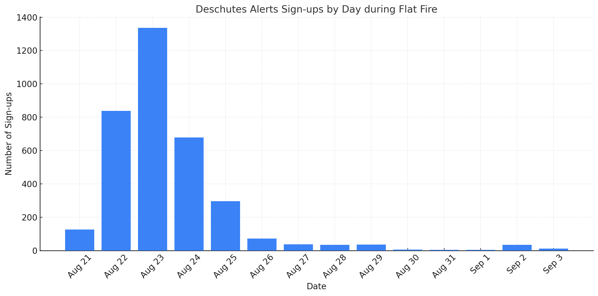
Bend, Ore. The recent Flat Fire sparked a dramatic surge in registrations for the Deschutes Alerts program across Deschutes County, with over 3,500 new sign-ups in less than a week. On August 23 alone, over 1,300 residents registered in a single day. That brings the total sign-ups to 70,976 across the county.

Deschutes Alerts is the county’s official emergency notification system, allowing people to receive urgent warnings about evacuations, severe weather, hazardous materials incidents, law enforcement activity, missing or endangered persons, and other threats to public safety. Alerts can be delivered via text message, phone call, email, TTD/TTY, and more based on the locations you care about.

Post-fire data developed by the Deschutes County Sheriff’s Office Emergency Management team shows that people all over the county signed up, not just in areas impacted by the Flat Fire. The large spike in new registrations occurred when the Flat Fire was most active and threatened several neighborhoods and about 4,000 structures, including homes.

“Emergencies can happen with little or no notice, and the Flat Fire was a reminder of how quickly situations can change,” said Ashley Volz, Emergency Services Coordinator for the Deschutes County Sheriff’s Office. “Deschutes Alerts is one of the best ways for you and your family to stay informed and safe when minutes matter. And it’s designed for other emergencies when public safety is at risk, not just wildfires."

Deschutes Alerts is reserved strictly for emergencies. It is not used for general updates or informational purposes. Notifications are sent only when residents should take protective actions such as evacuating, sheltering in place, or being on the lookout for a dangerous individual. Alerts are only sent to households directly affected by a fire or other emergency. Your home is not impacted if you don't receive one.

People who have signed up for Deschutes Alerts are most familiar with messages about the pending danger of active wildfires. They are only sent to people within evacuation areas once a wildfire begins to threaten people and structures. The Sheriff’s Office uses an alert system with three evacuation levels:

  • Level 1 – Be Ready: Be aware of danger in your area and prepare for possible evacuation.
  • Level 2 – Be Set: Be ready to leave at a moment’s notice. There is significant danger.
  • Level 3 – Go Now: Leave immediately. Danger is present, and there is no time to gather belongings.

In addition to notifying residents of escalating danger, Deschutes Alerts also informs people when the emergency has passed or when evacuation levels have been lowered from Level 3 to Level 2, providing clear guidance on when it is safe to return home.

Sign Up Before an Emergency

One of the most important steps people can take is registering before an emergency occurs. Waiting until an event unfolds may be too late to receive the first critical alert, especially during fast-moving incidents like wildfires or law enforcement emergencies.

People must use their physical address (not a P.O. Box or mailing address) when registering. Providing a physical address ensures that you receive alerts pertinent to your area. Emergency managers draw an alert area on a map, and people who have registered an address inside that boundary receive the notification. You may not receive an alert without a physical address in the system, even if you live in the impacted area.

How to Register

Signing up for Deschutes Alerts is quick and free. Call the Deschutes County Sheriff’s Office at 541-388-6501 for assistance registering, or sign up online at: deschutesalerts.org

The service area includes Deschutes County, Crooked River Ranch, and Camp Sherman. Deschutes Alerts is made possible through the OR-Alert program, a statewide alert and warning initiative. Visit oralert.gov to find your county’s alert and warning program.

Contact Information:

Jason Carr, Public Information Officer
(541) 904-5863
jason.carr@deschutes.org

###

Deschutes County Woman Arrested In Suspected Puppy Mill Case; 49 Animals Seized Or Surrendered (Photo) - 09/09/25

Bend, OR – On Friday, September 5, 2025, the Deschutes County Sheriff’s Office executed a search warrant at a residence on Elk Lane in Alfalfa, leading to the arrest of Lorinda Maxwell, 62, on 49 felony counts of Animal Neglect in the Second Degree.

The case began earlier this month when a woman who purchased a dog through the website rescueme.org contacted the Sheriff’s Office with concerns about the animal’s health. Maxwell uses the business name Kameo Poodles. Deputies and Animal Control Technicians responded and discovered what they suspect to be a puppy mill. After Maxwell refused to surrender the dogs voluntarily, the Sheriff’s Office sought and was granted a search warrant.

DCSO Animal Control seized 44 dogs from the home. Maxwell also voluntarily surrendered two additional dogs and three cats. The dogs, a mix of standard, miniature, and toy poodles—including two litters of puppies—were found in filthy, unhealthy conditions inside the residence. Animal Control Technician Maryia Leufven noted a strong odor of urine and ammonia, with many animals living in dirty crates and on soiled blankets. 

Many dogs were observed to need medical care and treatment based on their physical condition and lack of grooming. Poodles need regular grooming every 6–8 weeks because if neglected, their coats can develop heavy, painful curls that pull on their skin. They are also prone to dental issues and ear infections without proper care.

“Our Animal Control Technicians are committed to protecting animals in our community and are highly trained to notice signs of neglect,” said Jason Carr, Public Information Officer for the Deschutes County Sheriff’s Office.

“In this case, we believe Maxwell prioritized quantity over quality with profit as the main goal. And given how long she’s been breeding and the unhealthy conditions in the home, we’re considering this a puppy mill.”

Maxwell was arrested on Friday and transported to the Deschutes County Adult Jail without incident. The animals were taken to the Humane Society of Central Oregon, where they are receiving medical care and will remain pending the outcome of this case. Unfortunately, they are not available for adoption at this time.

Because of the scale of this investigation, the Sheriff’s Office is asking anyone with information to come forward. If you have knowledge about this case or have purchased animals from Kameo Poodles or Lorinda Maxwell, please call non-emergency dispatch at 541-693-6911. Even small details could be valuable to investigators. 

Humane Society of Central Oregon Asks for Resources & Donations 

The dog kennels at the Humane Society of Central Oregon (HSCO) are at 200% capacity. The newly arrived animals are on a court hold, and HSCO cannot share details or a timeline for adoption. Caring for animals from neglect cases requires significant resources. Community members who want to help can make the greatest impact by adopting or fostering an available dog, or by making a donation to support the ongoing care of these dogs and others in need at www.hsco.org. To allow staff to focus on animal care, we ask the public to direct any questions about the case to DCSO.  

###

Class Prepares Volunteers To Mentor Children Of Incarcerated Parents (Photo) - 09/09/25

Central Oregon Partnerships for Youth (COPY), a program of the Deschutes County Sheriff’s Office, is offering a class to prepare volunteers to become mentors for children with an incarcerated parent.

After initial training and background checks, volunteers are matched with a child that shares similar interests and commits to spending a few hours a week together for a minimum of one year. This time is often spent on outside activities, exploring the community, doing art or craft projects, or simply hanging out and talking.

On Saturday, September 27, COPY will offer an orientation/training class. This 3½ -hour class covers program policies, how to establish a mentor relationship, the impact incarceration has on families, and communication skills. There is no cost to attend, but advanced registration is required.

For additional details please call 541-388-6651 or email COPY@deschutes.org Additional program information is available at the Sheriff’s Office web site at www.sheriff.deschutes.org/copy

All Evacuation Levels For The Flat Fire Lifted By The Deschutes County Sheriff's Office - 09/08/25

Sisters, Ore. --  The Deschutes County Sheriff’s Office, in coordination with incident command staff, has officially lifted all evacuation levels related to the Flat Fire.

With the fire now fully contained, the threat to the community has been significantly reduced. Citizens may continue to see fire crews in the area conducting mop-up operations and monitoring for hot spots.

The Sheriff’s Office extends its gratitude to the many local, state, federal, and contract firefighters, dispatch centers, public safety agencies, and community-based organizations that supported this response. Their coordinated efforts protected thousands of homes and structures, even as several were unfortunately lost.

Residents are reminded to remain cautious when entering previously evacuated areas, as hazards such as weakened trees and hot ash pockets may still be present.

For continued wildfire updates, visit the Central Oregon Fire Info webpage. 

###

Closure Reached As Final Person From The Dillon Falls Tragedy On July 19 Identified; Family Notified - 09/04/25

***DATE CORRECTION: The Incident Occurred on July 19, not July 12 as previously stated. It has been updated in this version of the media release.***

Bend, Ore. -- The Deschutes County Sheriff’s Office has confirmed the recovery and identification of the third and final individual from the July 19 incident at Dillon Falls.

On August 27, two kayakers exploring Lava Island Falls on the Deschutes River discovered the body in the rapids, downstream from Dillon Falls. Search and Rescue teams, assisted by Bend Fire & Rescue, conducted a complex recovery operation in an inaccessible area with swift water that took about five hours to complete.

The Deschutes County Medical Examiner has identified the body as Derek Slesinger, 33, of Newark, Delaware. He was visiting Central Oregon as part of a group of six friends recreating in the area on the weekend of the incident. Three tragically died, and three survived. The other two victims who lost their lives included:

  • Amanda I. Loyd, 39, of Rockwall, Texas
  • Lindsay V. Bashan, 33, of Parkland, Florida

Following confirmation of Slesinger’s identity, Sheriff Ty Rupert met with his mother. She asked that her family remain out of the public eye but offered heartfelt thanks to the Sheriff’s Office, detectives, and especially the Search and Rescue teams whose efforts she greatly appreciates. She shared that, although the loss has been heartbreaking, she is grateful to finally have closure and the opportunity to honor her son’s life.

“We are incredibly grateful to our Search and Rescue volunteers for their tireless dedication and to the kayakers who came forward when they discovered Derek. Most importantly, we are thankful his family has answers and some measure of closure after weeks of uncertainty. That is what matters most,” said Deschutes County Sheriff Ty Rupert.

The recovery of Slesinger officially ends the search efforts connected to the Dillon Falls tragedy. Since July 19, Search and Rescue teams have devoted hundreds of hours to combing the stretch of river around Dillon Falls. Strong currents and Class VI rapids make recovery operations of this nature extremely difficult. Sections of the Deschutes River create additional challenges, with dangerous, unpredictable, and constantly shifting conditions. Slesinger was recovered in swift waters, and how Slesinger came to rest at Lava Island Falls will never be fully known.

"I also want to recognize the many partner agencies that assisted throughout these operations—Bend Fire & Rescue, Bend Police Department, The Portland Police Bureau, Civil Air Patrol, the Oregon State Marine Board, Multnomah County Sheriff’s Office, AirLink, and Leading Edge Aviation,” added Sheriff Rupert. “These efforts take teamwork, persistence, and coordination across many agencies, and I am proud of everyone who contributed. In the end, it was a combination of that teamwork and two kayakers being in the right place at the right time that allowed us to bring this case to a close.”

The Sheriff’s Office reminds the public that rivers can be unpredictable and dangerous. It’s essential to plan ahead, know take-out locations on rivers, obey all posted warnings, and always have a life jacket. These steps are critical for anyone recreating on local waterways.

Statement by Derek Slesinger’s Mother, Diana Adames

On behalf of my family, I want to thank the Deschutes County Sheriff’s Office, Search and Rescue, and all of the agencies and people who helped bring closure to this accident.

There have been a lot of rumors about what happened, but the truth is, most people don’t know or understand the whole story. I spent many days out on the river and was treated with such kindness by the Search and Rescue teams. They went above and beyond, spending more time than anyone can imagine searching for my boy. I also want to thank Sheriff Rupert, who kept me updated, took all my calls, and supported me every step of the way. I am deeply grateful to the kayakers who noticed my son in the river and came forward.

We may never know exactly where Derek was all this time or why he ended up downriver. None of that matters to me. What matters is that I can finally bring my son home, let him rest in peace, and close this chapter.

I also want to thank community members, like my new friends Piera and Kerri, who embraced, supported, and showed me kindness. Local businesses stepped up, such as Hook & Plow, Dear Mom Cafe, Still Vibrato, Donner Flower Shop, and 10 Barrel, who were so good to me. I’ll never forget it. They showed me the wonderful side of humanity.

As my family and I bring Derek home, I ask that our privacy be respected so we can say goodbye and let him rest in peace. Please know that my gratitude to this community, the Deschutes County Sheriff’s Office, its Search & Rescue teams, and everyone who stood by me is heartfelt and will remain with me forever.

Diana Adames

Continued Progress On The Flat Fire Allows The Deschutes County Sheriff's Office To Further Reduce Or Lift Evacuation Orders - 09/02/25

Sisters, Ore -- All evacuation orders in Deschutes County have now been lifted or reduced to Level 1 (Be Ready) as firefighters continue to make substantial progress on the Flat Fire.

Effective 9:00 a.m. today, the Deschutes County Sheriff’s Office, in consultation with the incident commander, downgraded all remaining Level 2 (Be Set) areas to Level 1. This marks the first time since the fire began that no areas are under Level 2 or Level 3 evacuation orders.

Residents returning home should remain cautious. Fire equipment is still patrolling and working in the area, and hazards such as weakened trees, stump holes, and pockets of hot ash remain within the fire zone.

Effective 9 a.m. today (September 2, 2025), the following Level 2 (Be Set) areas are being reduced to Level 1 (Be Ready):

  • Wilt Rd from Big Buck Ln to the County Line, including Blazer Ln and Maria Ln
  • Whychus Canyon Estates and Mountain View Rd to the end.
  • Panoramic Estates and Emerald Valley Rd area.
  • The area North of Edmundson Rd between Panoramic Estates and Holmes Rd, north to Wychus Creek.
  • Area North along both sides of Holmes Road from Edmundson Rd to Lower Bridge Rd. Including Wanona Rd, Goldcoach Rd, Crawford Trl, McSwain Dr, and Running Horse Ct.

Also, effective 9 a.m. today (September 2, 2025), evacuation orders have been lifted from the following areas:

  • Stevens Canyon area
  • Residences off Wilt Rd between Camp Polk Rd and Big Buck Ln
  • Henkle Butte area, including Stardust Ln, Canyon Crest Dr, and Vista Ridge Dr
  • Junipine Acres on Fair Mile Rd, including Wren Ln, and Suntree Ln
  • Camp Polk Meadow and Old Military Rd Area
  • Area East of Wychus Creek to Camp Polk Rd, North of Highway 126 to include the Junipine Lane, Bitterbrush subdivision, and Hawksflight Dr.
  • Aspen Lakes subdivision and golf course
  • Hurtley Ranch Road South of Emerald Valley Rd
  • Area between Edmundson Rd and Hwy 126, including Goodrich Road, Holmes Road, and Fadjur Ln
  • Both Upper and Lower portions of McKenzie Canyon
  • Area North and East of Lower Bridge Rd to the Deschutes River

 We will continue to evaluate conditions and adjust evacuations as necessary.

The current evacuation areas are as follows:

LEVEL 1 (BE READY):

  • Wilt Rd from Big Buck Ln to the County Line, including Blazer Ln and Maria Ln
  • Whychus Canyon Estates and Mountain View Rd to the end.
  • Panoramic Estates and Emerald Valley Rd area.
  • The area North of Edmundson Rd between Panoramic Estates and Holmes Rd, north to Wychus Creek.
  • Area North along both sides of Holmes Road from Edmundson Rd to Lower Bridge Rd. Including Wanona Rd, Goldcoach Rd, Crawford Trl, McSwain Dr, and Running Horse Ct.

Level 1 Means “BE READY“ for potential evacuation. Residents should be aware of the danger in their area and monitor emergency services websites and local media outlets for information. This is the time for preparation and precautionary movements of persons with special needs, mobile property, and (under certain circumstances) pets and livestock. Emergency services personnel may contact you via an emergency notification system if conditions worsen.

IMPORTANT RESOURCES

Good News From The Flat Fire: All Level 3 (Go Now) Evacuation Orders Lifted; Some Level 2 (Be Set) Zones Reduced To Level 1 (Be Ready) (Photo) - 08/28/25

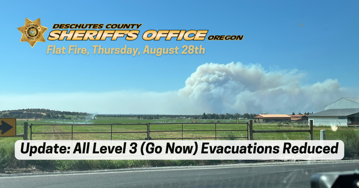
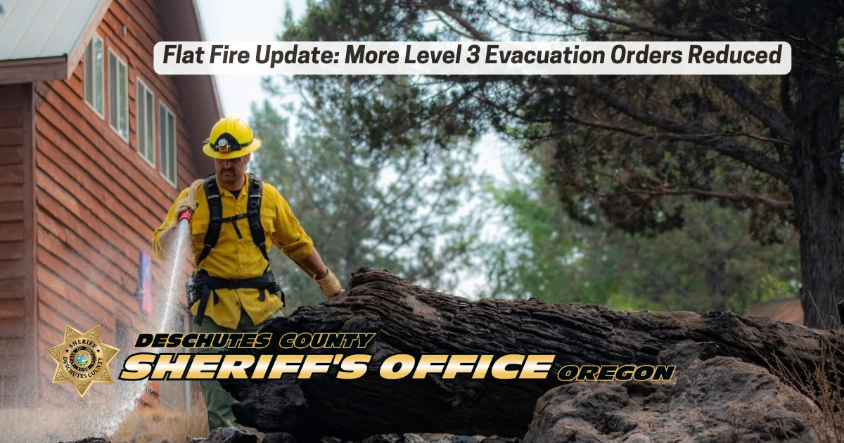
Sisters, Ore. -- For the first time since the Flat Fire began, all Level 3 (Go Now) evacuation orders in Deschutes County have been dropped. Significant progress on fire lines today has allowed the Deschutes County Sheriff’s Office—working in coordination with incident commanders and fire operations—to reduce all Level 3 areas to Level 2 (Be Set).

In addition, several Level 2 (Be Set) areas have been reduced further to Level 1 (Be Ready). If you choose to return home, please remain Be Ready or Be Set to leave again should conditions change. Also, be aware of fire equipment and smoky conditions in the area.

Effective 5 p.m. today (August 28, 2025), all remaining Level 3 (Go Now) areas are reduced to Level 2 (Be Set):

  • The 17700 Block of Mountain View Rd north to the end

  • Henkle Butte area, including Stardust Ln, Canyon Crest Dr, and Vista Ridge Dr

  • Wilt Rd from Big Buck Ln to the County Line

  • Both sides of Edmundson Rd between Holmes Rd and Goodrich Rd

  • Between Wilt Rd MP 4 West to Stevens Canyon North to the County Line

  • Residences on the north end of Mountain View Rd, north of the 17700 Block

  • Both sides of Wilt Rd from Big Buck Ln north to the Deschutes/Jefferson County line

  • Areas North and West of Holmes Rd, North of milepost 5 to Lower Bridge Rd

  • The upper (Southern) portion of McKenzie Canyon

  • Panoramic Estates off Camp Polk Rd

Also effective 5 p.m. today, the following Level 2 (Be Set) areas are reduced to Level 1 (Be Ready):

  • Old Military Rd

  • Camp Polk Meadow and Cemetery area

  • Junipine Acres on Fair Mile Rd, including Wren Ln and Suntree Ln

  • Residences off Wilt Rd between Camp Polk and Stardust

  • Lower (Northern) portion of McKenzie Canyon

  • Stevens Canyon area

  • Aspen Lakes Subdivision and golf course

  • Hurtley Ranch Rd south of Emerald Valley Rd

  • Area between Camp Polk Rd, west along Hwy 126 to include the Junipine Ln area, and north to Old Military Rd

  • Area North and East of Lower Bridge Rd to the Deschutes River

  • Areas north of Hwy 126, including Goodrich Rd, Holmes Rd, and Fadjur Ln

We will continue to evaluate conditions and adjust evacuations as necessary.


The current evacuation areas are as follows:

LEVEL 2 (Be Set)

  • Whychus Canyon Estates from Wilt Rd north to the end of Mountain View Rd

  • Henkle Butte area, including Stardust Ln, Canyon Crest Dr, and Vista Ridge Dr

  • Wilt Rd from Stardust to the county line

  • Wilt Rd from Big Buck Ln to the County Line

  • Both sides of Edmundson Rd between Holmes Rd and Goodrich Rd

  • Between Wilt Rd MP 4 West to Stevens Canyon North to the County Line

  • Areas North and West of Holmes Rd and Edmundson to Lower Bridge Rd

  • The upper (Southern) portion of McKenzie Canyon

  • Panoramic Estates off Camp Polk Rd

Level 2 means Be Set to evacuate. Prepare to leave at a moment’s notice. This level indicates significant danger to your area. Residents should consider relocating or be ready to evacuate at a moment’s notice. Emergency services may not be able to notify you if conditions deteriorate.


LEVEL 1 (Be Ready)

  • Dry Canyon area between Lower Bridge Rd south to Hwy 126

  • Old Military Rd

  • Camp Polk Meadow and Cemetery area

  • Junipine Acres on Fair Mile Rd, including Wren Ln and Suntree Ln

  • Residences off Wilt Rd between Camp Polk and Stardust

  • Lower (Northern) portion of McKenzie Canyon

  • Stevens Canyon area

  • Aspen Lakes Subdivision and golf course

  • Hurtley Ranch Rd south of Emerald Valley Rd

  • Area between Camp Polk Rd, west along Hwy 126 to include the Junipine Ln area, and north to Old Military Rd

  • Area North and East of Lower Bridge Rd to the Deschutes River

  • Areas north of Hwy 126, including Goodrich Rd, Holmes Rd, and Fadjur Ln

Level 1 means Be Ready for potential evacuation. Be aware of danger in your area and monitor emergency services websites and local media. This is the time to prepare, especially for those with special needs, mobile property, pets, and livestock.


IMPORTANT RESOURCES

Attached Media Files: Flat Fire Update.png,

Flat Fire Update: The Deschutes County Sheriff's Office Reduces More Evacuation Orders, One Additional Structure Loss Confirmed - 08/27/25

Sisters, Ore -- Another day of favorable weather and substantial firefighting progress has allowed the Deschutes County Sheriff’s Office, in consultation with incident commanders, to reduce evacuation levels further.

During today’s assessments, the Sheriff's Office confirmed one additional property with destroyed buildings, which includes a residence and an outbuilding. This brings the total number of homes lost in Deschutes County to five. Three are primary residences and two are secondary residences. 

If you choose to return home, Be Set to leave again should conditions change. Heavy fire equipment remains in the area, and smoky conditions may impact travel and visibility.

Evacuation Changes – Effective 5:00 p.m. today

The following areas have been downgraded from Level 3 (Go Now) to Level 2 (Be Set):

  • Whychus Canyon Estates from Wilt Road north to the 17700 Block of Mountain View Road

  • Henkle Butte area, including Stardust Lane, Canyon Crest Drive, and Vista Ridge Drive

  • Wilt Road from Buffalo Drive to Big Buck Lane

Current Evacuation Levels

LEVEL 3 (GO NOW):

  • Both sides of Edmundson Rd between Holmes Rd and Goodrich Rd

  • Between Wilt Rd MP 4 west to Stevens Canyon north to the County line

  • Residences on the north end of Mountain View Rd, north of the 17700 Block

  • Both sides of Wilt Road from Big Buck Ln north to the Deschutes/Jefferson County line

  • Areas north and west of Holmes Road, north of MP 5 to Lower Bridge Rd

  • Upper (southern) portion of McKenzie Canyon

  • Panoramic Estates off Camp Polk Road

LEVEL 2 (BE SET):

  • Whychus Canyon Estates from Wilt Rd north to the 17700 Block of Mountain View Rd

  • Henkle Butte area, including Stardust Ln, Canyon Crest Dr, and Vista Ridge Dr

  • Wilt Rd from Buffalo Dr to Big Buck Ln

  • Old Military Rd

  • Camp Polk Meadow and Cemetery area

  • Junipine Acres on Fair Mile Rd, including Wren Ln and Suntree Ln

  • Residences off Wilt Rd between Camp Polk and Stardust

  • Lower (northern) portion of McKenzie Canyon

  • Stevens Canyon area

  • Aspen Lakes subdivision and golf course

  • Hurtley Ranch Rd south of Emerald Valley Rd

  • Area between Camp Polk Rd west along Hwy 126 to Junipine Ln, and north to Old Military Rd

  • Area north and east of Lower Bridge Rd to the Deschutes River

  • Areas north of Hwy 126, including Goodrich Rd, Holmes Rd, and Fadjur Ln

LEVEL 1 (BE READY):

  • Areas on the north side of East Indian Ford Rd, from Wilt Rd to FS Road 2050, including Stevens Canyon Rd to MP 1.5, Fox Ridge Circle, and Pine Ridge Rd

  • Dry Canyon area between Lower Bridge Rd, south to Hwy 126

  • Area between Indian Ford Creek and Whychus Creek, north of Hwy 126 to the Camp Polk Rd/Wilt Rd intersection (including Indian Ford Ranch, Deer Ridge, Pine Ridge Loop, and McKinney Butte subdivisions)

Recovery Operation Underway At Lava Island Falls On The Deschutes River Near Bend - 08/27/25

Bend, OR -- The Deschutes County Sheriff’s Office Search and Rescue and Bend Fire & Rescue are conducting a recovery operation on the Deschutes River at Lava Island Falls southwest of Bend.

Around 2:30 p.m., kayakers discovered a body at Lava Island Falls after paddling to the island to take photos. The area of the river where the body was found is extremely difficult to access, and recovery crews estimate it will take at least four to five hours to complete the operation safely. The identity of the body is not known.

The operation is taking place in an area not accessible to the public. We ask community members to please avoid the area and allow first responders the space to complete this complex recovery.

We will provide another update with additional information as it becomes available.

###

Another Day Of Improved Weather Conditions Allows The Deschutes County Sheriff's Office To Reduce Level 3 (Go Now) Evacuation Areas For Some Areas Of The Flat Fire (Photo) - 08/26/25

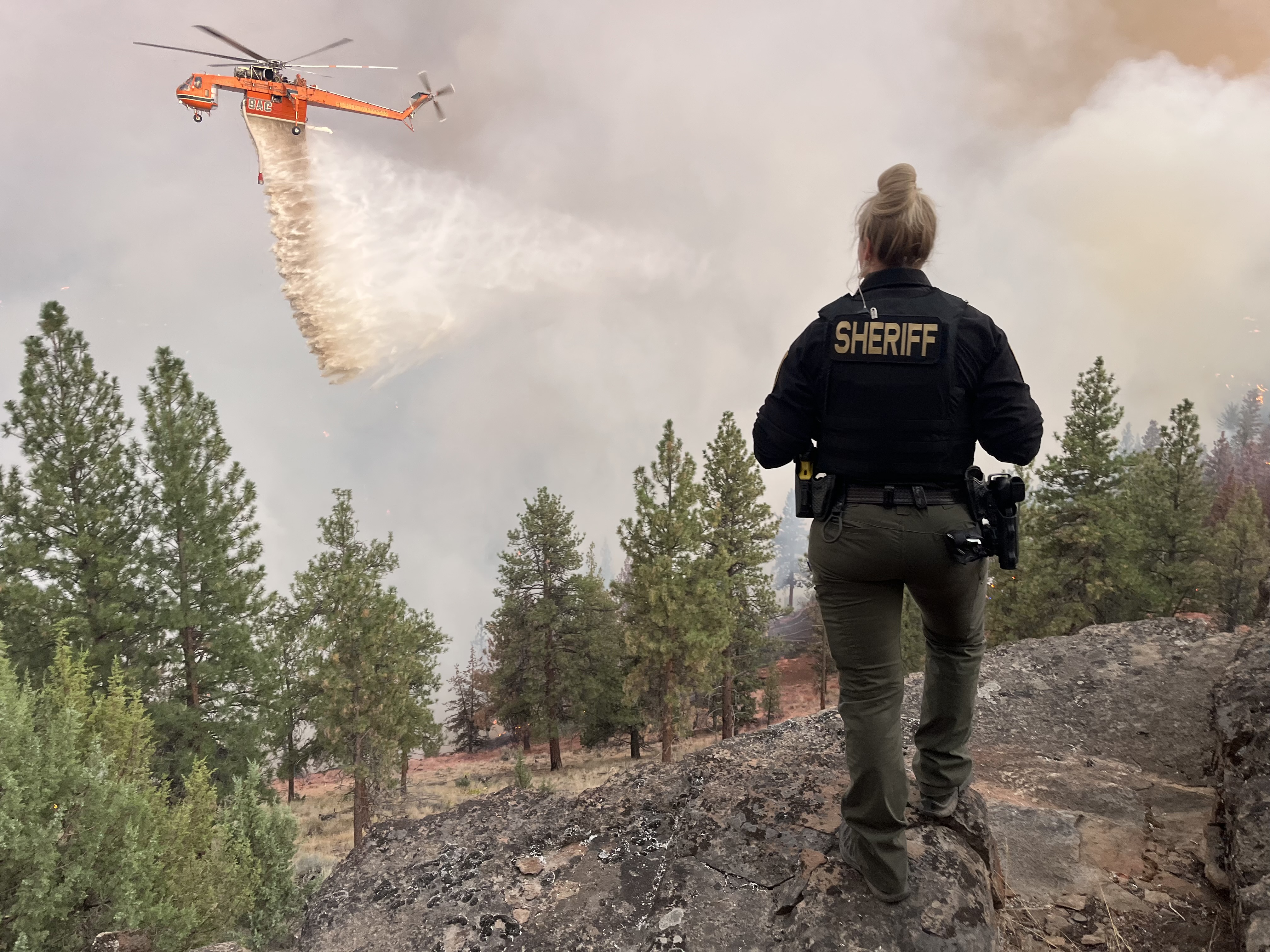
Sisters, Ore -- As of 5 p.m. on Tuesday, August 26, additional areas of the Flat Fire under Level 3 (Go Now) evacuation orders have been reduced to Level 2 (Be Set). Another day of improved weather conditions and significant progress on the lines allowed the Deschutes County Sheriff’s Office to reduce some evacuation levels in consultation with incident commanders and fire operations.

If you choose to return home, please Be Set to leave again should conditions change. Also, be aware of fire equipment and smoky conditions in the area.

Effective 5 p.m. today (August 26, 2025), the following areas are being reduced from Level 3 (Go Now) to Level 2 (Be Set):

  • Old Military Rd
  • Camp Polk Meadow and Cemetery area
  • Junipine Acres on Fair Mile Rd, including Wren Ln, and Suntree Ln
  • Residences off of Wilt Rd between Camp Polk Rd and Stardust Ln (Note: Stardust Ln is still Level 3 (Go Now).

 We will continue to evaluate conditions and adjust evacuations as necessary.

The current evacuation areas are as follows:

LEVEL 3 (GO NOW):

  • Both sides of Edmundson Rd between Holmes Rd and Goodrich Rd
  • Between Wilt Rd MP 4 West to Stevens Canyon North to the County Line
  • Whychus Canyon Estates south to Camp Polk Rd
  • Both sides of Wilt Road north to the Deschutes/Jefferson County line
  • Areas North and West of Holmes Road North of milepost 5 to Lower Bridge Rd
  • The upper (Southern) portion of McKenzie Canyon
  • Panoramic Estates off of Camp Polk Road

Level 3: Means “GO” evacuate now. Leave immediately! Danger to your area is current or imminent, and you should evacuation immediately. If you choose to ignore this advisement, you must understand that emergency services may not be available to assist you further. DO NOT delay leaving to gather any belongings or make efforts to protect your home. This will be the last notice you receive.

LEVEL 2 (GET SET)

  • Old Military Rd
  • Camp Polk Meadow and Cemetery area
  • Junipine Acres on Fair Mile Rd, including Wren Ln, and Suntree Ln
  • Residences off of Wilt Rd between Camp Polk and Stardust
  • Lower (Northern) portion of McKenzie Canyon
  • Stevens Canyon area
  • Aspen Lakes Subdivision and golf course
  • Hurtley Ranch Road south of Emerald Valley Rd
  • Area between Camp Polk Road, West along Highway 126 to include the Junipine Lane area, and north to Old Military Road
  • Area North and East of Lower Bridge Rd to the Deschutes River
  • Areas north of Hwy 126, including Goodrich Road, Holmes Road, and Fadjur Lane

Level 2: Means “BE SET” to evacuate. You must prepare to leave at a moment’s notice. This level indicates significant danger to your area, and residents should either voluntarily relocate to a shelter or with family and friends outside of the affected area, or if choosing to remain, to be ready to evacuate at a moment’s notice. Residents MAY have time to gather necessary items, but doing so is at their own risk. This may be the only notice you receive. Emergency services cannot guarantee that they will be able to notify you if conditions rapidly deteriorate. Area media services will be asked to broadcast periodic updates.

LEVEL 1 (BE READY):

  • Areas on the North side of East Indian Ford Road, from Wilt Rd to FS Road 2050 including Stevens Canyon Road to MP 1.5, Fox Ridge Circle, and Pine Ridge Road.
  • Dry Canyon area between Lower Bridge Rd, South to Hwy 126
  • Area between Indian Ford Creek and Wychus Creek, north of Hwy 126 to Camp Pollk Rd/Wilt Rd intersection. It also includes Indian Ford Ranch, Deer Ridge, Pine Ridge Loop, and McKinney Butte Subdivisions.

Level 1 Means “BE READY“ for potential evacuation. Residents should be aware of the danger in their area and monitor emergency services websites and local media outlets for information. This is the time for preparation and precautionary movements of persons with special needs, mobile property, and (under certain circumstances) pets and livestock. Emergency services personnel may contact you via an emergency notification system if conditions worsen.

IMPORTANT RESOURCES

  • A Red Cross Shelter is set up at Highland Baptist Church, 3100 SW Highland Ave, Redmond, OR. It operates 24 hours a day and provides a safe place for overnight stays, drop-ins, and access to food and other resources.
  • A call center is now operational, providing information about evacuations. That number is 541-550-4888.
  • Large animals have been offered shelter at Kerley Horse Center at 11997 SW Cornett Loop, Powell Butte, OR 97753, 541-598-6358.
  • We will continue to work closely with fire managers and provide updates as the situation develops. Please follow official channels for accurate information.
  • Current maps, including evacuation areas, can be found at: https://deschutes.org/emergency
  • For fire information, visit the Central Oregon Fire Information site at www.centraloregonfire.org  and follow the Flat Fire on Facebook.
  • Make sure you are registered for Deschutes Alerts to receive evacuation and emergency alerts and warnings in your area by going to www.deschutesalerts.org
Attached Media Files: Evac Reduced Again.png,

FLAT FIRE UPDATE: Improved Weather And Firefighting Progress Allow Reduction Of Some Evacuation Levels - 08/25/25

Sisters, Ore -- With today's improved weather conditions and significant progress on the lines, the Deschutes County Sheriff’s Office, in consultation with incident commanders and fire operations, is reducing some evacuation levels.

If you choose to return home at the time, please Be Set to leave again should conditions change. Also, be aware of fire equipment and smoky conditions in the area.

Effective 5 pm today (August 25, 2025), the following areas are being reduced from Level 3 (Go Now) to Level 2 (Be Set):

  • Lower (Northern) portion of McKenzie Canyon
  • Stevens Canyon area
  • Aspen Lakes Subdivision and Golf Course
  • Hurtley Ranch Road south of Emerald Valley Road

 We will continue to evaluate conditions and adjust evacuations as necessary.

The current evacuation areas are as follows:

LEVEL 3 (GO NOW):

  • Both sides of Edmundson Rd between Holmes Rd and Goodrich Rd
  • Between Wilt Rd MP 4 West to Stevens Canyon North to the County Line
  • Whychus Canyon Estates south to Camp Polk Rd
  • Both sides of Wilt Road north to the Deschutes/Jefferson County line
  • Areas North and West of Holmes Road, North of milepost 5 to Lower Bridge Rd
  • The upper (Southern) portion of McKenzie Canyon
  • Panoramic Estates off of Camp Polk Road

Level 3: Means “GO” evacuate now. Leave immediately! Danger to your area is current or imminent, and you should evacuation immediately. If you choose to ignore this advisement, you must understand that emergency services may not be available to assist you further. DO NOT delay leaving to gather any belongings or make efforts to protect your home. This will be the last notice you receive.

LEVEL 2 (GET SET)

  • Lower (Northern) portion of McKenzie Canyon
  • Stevens Canyon area
  • Aspen Lakes Subdivision and golf course
  • Hurtley Ranch Road south of Emerald Valley Rd
  • Area between Camp Polk Road, West along Highway 126 to include the Junipine Lane area, and north to Old Military Road
  • Area North and East of Lower Bridge Rd to the Deschutes River
  • Areas north of Hwy 126, including Goodrich Road, Holmes Road, and Fadjur Lane

Level 2: Means “BE SET” to evacuate. You must prepare to leave at a moment’s notice. This level indicates significant danger to your area, and residents should either voluntarily relocate to a shelter or with family and friends outside of the affected area, or if choosing to remain, to be ready to evacuate at a moment’s notice. Residents MAY have time to gather necessary items, but doing so is at their own risk. This may be the only notice you receive. Emergency services cannot guarantee that they will be able to notify you if conditions rapidly deteriorate. Area media services will be asked to broadcast periodic updates.

LEVEL 1 (BE READY):

  • Areas on the North side of East Indian Ford Road, from Wilt Rd to FS Road 2050, including Stevens Canyon Road to MP 1.5, Fox Ridge Circle, and Pine Ridge Road.
  • Dry Canyon area between Lower Bridge Rd, South to Hwy 126
  • Area between Indian Ford Creek and Wychus Creek, north of Hwy 126 to Camp Pollk Rd/Wilt Rd intersection. It also includes Indian Ford Ranch, Deer Ridge, Pine Ridge Loop, and McKinney Butte Subdivisions.

Level 1 Means “BE READY“ for potential evacuation. Residents should be aware of the danger in their area and monitor emergency services websites and local media outlets for information. This is the time for preparation and precautionary movements of persons with special needs, mobile property, and (under certain circumstances) pets and livestock. If conditions worsen, emergency services personnel may contact you via an emergency notification system.

IMPORTANT RESOURCES

  • A Red Cross Shelter is set up at Highland Baptist Church, 3100 SW Highland Ave, Redmond, OR. It operates 24 hours a day and provides a safe place for overnight stays, drop-ins, and access to food and other resources.
  • A call center is now operational, providing information about evacuations. That number is 541-550-4888.
  • Large animals have been offered shelter at Kerley Horse Center at 11997 SW Cornett Loop, Powell Butte, OR 97753, 541-598-6358.
  • Current maps, including evacuation areas, can be found at: https://deschutes.org/emergency
  • For fire information, visit the Central Oregon Fire Information site at www.centraloregonfire.org  and follow the Flat Fire on Facebook.
  • Make sure you are registered for Deschutes Alerts to receive evacuation and emergency alerts and warnings in your area by going to www.deschutesalerts.org

###

Flat Fire Update: Evacuation Orders Remain In Place; Sheriff Urges Public To Respect Road Closures (Photo) - 08/25/25

Sisters, Ore. -- As the Flat Fire enters another day of firefighting efforts, the Deschutes County Sheriff's Office is sharing the latest on road closures and what it means for residents in evacuation zones. Deschutes County Sheriff Ty Rupert’s message to the community today is this: road closures remain in place for public and firefighter safety. While it's understandable that the public is interested in the effects of the fire, the Sheriff asks that people refrain from driving into closure areas. Extra traffic can put the public and fire crews at risk and interfere with critical firefighting operations.

Key Updates:

  • Evacuations: Since Saturday evening, no new evacuation orders have been issued in Deschutes County. Existing evacuations remain in place, and any changes will be based on fire activity. 
  • Fire Size & Containment: 21,971 acres burned and 5% containment.
  • Firefighting Progress: Crews continue strengthening fire lines and are responding to spot fires. Fire growth to the south toward Sisters and Highway 126 has been held in place.
  • Structures: Damage assessments remain unchanged from Sunday night. Four homes have been lost, one home damaged, six “other structures” lost (garage, barn, shed, or pump house), and one “other structure” damaged. There are 827 structures identified in or near the fire perimeter, and most remain standing thanks to the heroic work of fire crews and homeowners who created defensible space around their properties.
  • Community Meeting: Fire and emergency managers will provide updates during a public meeting at 6:00 p.m. tonight at Sisters High School.

Sheriff Rupert and the Sheriff’s Office Emergency Services Unit continue receiving daily updates and remain committed to providing the community with timely updates as information and fire activity change.

Flat Fire Information & Resources:

  • Current maps, including evacuation areas, can be found at: https://deschutes.org/emergency
  • For fire information, visit the Central Oregon Fire Information site at www.centraloregonfire.org and follow the Flat Fire on Facebook.
  • Make sure you are registered for Deschutes Alerts to receive evacuation and emergency alerts and warnings in your area by going to www.deschutesalerts.org
  • Flat Fire Facebook Page: https://www.facebook.com/FlatFire
  • The Flat Fire Assistance Line is (541) 550-4888, staffed from 8 a.m. to 8 p.m. daily. If you call outside those hours, you can leave a voicemail, and someone will return your call as soon as possible
  • The Red Cross has set up a Shelter at Highland Baptist Church, 3100 SW Highland Ave, Redmond, OR. It operates 24 hours a day and provides a safe place for overnight stays, drop-ins, and access to food and other resources.

###

Attached Media Files: Flat Fire Update 825.png,

Flat Fire Update: Four Homes Lost, Several Outbuildings Damaged In Deschutes County (Photo) - 08/24/25

Deschutes County, Ore. – Damage assessments from the Flat Fire, as of Sunday, August 24, have confirmed that several homes and outbuildings in Deschutes County have been lost or damaged, while hundreds more remain standing thanks to the work of firefighters and proactive property owners. The homes and structures affected are spread throughout the fire area.  

So far, we know of the following impacts: 

  • Residential structures destroyed: 4 

  • Residential structures damaged: 1 

  • Other structures destroyed: 6 

  • Other structures damaged: 1 

Residential structures include both primary and secondary residences. “Other structures” include shops, barns, garages, sheds, pump houses, and similar buildings. At this time, all known destroyed or damaged structures are located in Deschutes County. 

As of 11:30 p.m. on August 23, 2025, there were 827 structures located within and immediately surrounding the fire perimeter. This remains an active incident, and the number of destroyed or damaged structures could change as additional assessments are completed. 

“We are deeply saddened by the loss of homes and personal property and extend our sympathy to those affected,” said Deschutes County Sheriff Ty Rupert. “We are also encouraged that hundreds of homes have been protected thanks to aggressive firefighting efforts and the proactive work of property owners to reduce fuels around their homes.” 

Fire crews and emergency management personnel continue to assess the area and notify property owners when a damaged structure is identified. We will share updates if the numbers change. 

There have been no new evacuation orders today. As of our update from Saturday evening, all areas under Level 1 (Be Ready), Level 2 (Be Set), and Level 3 (Go Now) remain unchanged.

Flat Fire Information & Resources:
  • For fire information, visit the Central Oregon Fire Information site at www.centraloregonfire.org and follow the Flat Fire on Facebook.
  • Make sure you are registered for Deschutes Alerts to receive evacuation and emergency alerts and warnings in your area by going to www.deschutesalerts.org

(Photos are Courtesy of the Flat Fire Facebook Page)

###

FLAT FIRE ROAD CLOSURE UPDATE: SUNDAY AUGUST 24TH, 2:25 P.M. (Photo) - 08/24/25

***CORRECTION***

The road closure update is for Sunday, August 24, not Saturday, as stated in the original news release. We apologize for the error.

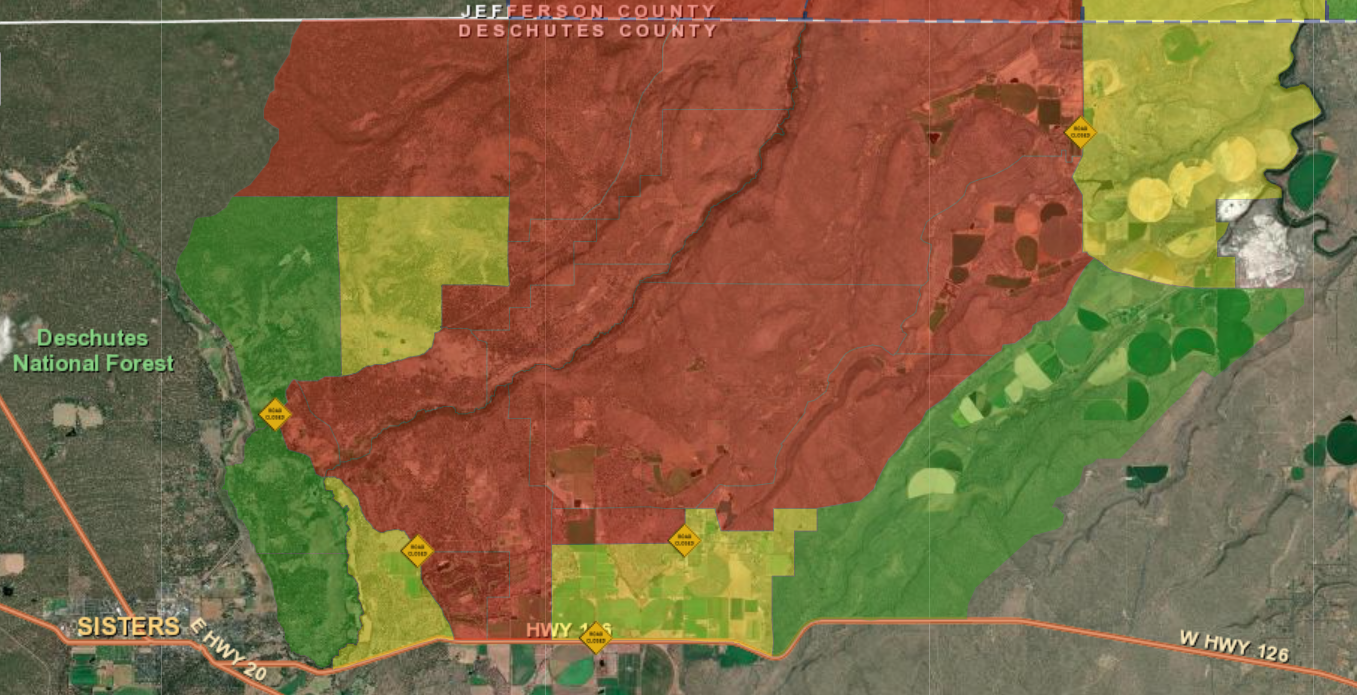
Sisters, Ore. -- The Deschutes County Sheriff’s Office is providing an update on road closures associated with the Flat Fire. Community members have been asking questions about access in the affected areas.

There are currently four primary road closures:

  • Wilt Road is closed at Camp Polk Road
  • Panoramic Drive is closed at Camp Polk Road
  • Goodrich Road is closed north of Hwy 126
  • Holmes Road is closed north of Fadjur Lane

For visual reference, a map has been created showing these closures. Yellow road signs on the map indicate closure points.

The map also highlights evacuation zones:

  • Red – Level 3 (Go Now)

  • Yellow – Level 2 (Be Set)

  • Green – Level 1 (Be Ready)

We encourage residents to monitor official updates and remain aware of changing conditions.

###

 
Attached Media Files: Road Closures.png,

FLAT FIRE EVACUATION UPDATE FOR DESCHUTES COUNTY: SUNDAY, AUGUST 24TH (Photo) - 08/24/25

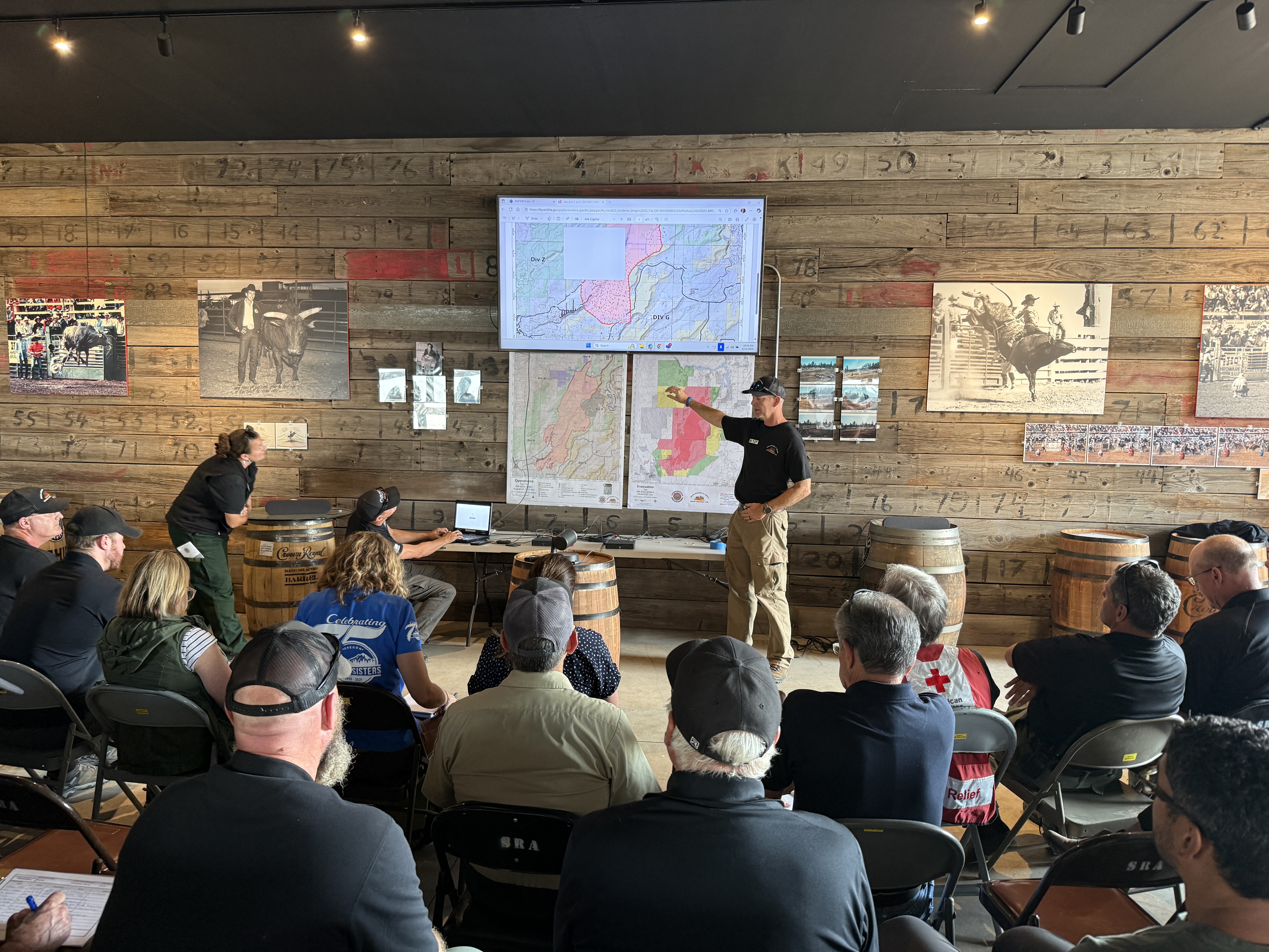
Sisters, Ore, -- Deschutes County Sheriff Ty Rupert and Lieutenant Nathan Garibay, with the Sheriff’s Office Emergency Management Unit, attended this morning’s Flat Fire briefing at the Sisters Rodeo grounds alongside state, regional, and local partners.

As of noon today:

  • Nearly 4,000 homes remain in evacuation zones, with approximately 1,000 homes in Level 3 (Go Now).

  • There are no changes to Deschutes County evacuation levels. The information shared last night remains current.

  • Fire managers report that many homes have been saved, crediting the outstanding work of fire crews and the efforts of homeowners who created defensible space around their properties.

The Sheriff’s Office is working today to confirm the status of homes and structures impacted by the fire. Updates will be shared as soon as new information becomes available.

The Flat Fire Assistance Line is available daily from 8:00 a.m. to 8:00 p.m. at (541) 550-4888. Voicemails left outside these hours will be returned as soon as possible.

The American Red Cross has opened a shelter at Highland Baptist Church, 3100 SW Highland Avenue, Redmond. The shelter is open 24 hours a day and provides a safe place for overnight stays, daytime drop-ins, meals, and additional resources.

The Deschutes County Sheriff’s Office thanks the fire crews, partner agencies, and community members working tirelessly to protect lives and property.

###

Evacuation Update: Aspen Lakes Subdivision And Edmunson Road Areas Added To Level 3, Go Now! (Photo) - 08/23/25

***FLAT FIRE EVACUATION UPDATE: Saturday, August 23rd, 8:08 p.m.***

The major update is that Aspen Lakes Subdivision off Camp Polk Road has been elevated to a Level 3 (Go Now) Evacuation order, along with both sides of Edmundson Rd between Holmes Rd and Goodrich Rd

Here is the latest information from fire managers: 

After consulting with local Fire Chiefs and incident commanders, the Deschutes County Sheriff’s Office has updated evacuation levels as the Flat Fire continues to grow and move. Based on the current and potential fire behavior today the following areas are now under Level 3 (GO NOW), Level 2 (GET SET), and Level 1 (BE READY) evacuation notices.  

Large animals have been offered shelter at Kerley Horse Center, 11997 SW Cornett Loop, Powell Butte, OR 97753, 541-598-6358.  

LEVEL 3 (GO NOW): 

  • Aspen Lakes Subdivision off of Camp Polk Road 

  • Both sides of Edmundson Rd between Holmes Rd and Goodrich Rd 

  • Between Wilt Rd MP 4 West to Stevens Canyon North to the County Line 

  • Whychus Canyon Estates south to Camp Polk Rd to  

  • Both sides of Wilt Road north to the Deschutes/Jefferson County line 

  • Areas North and West of Holmes Road, North of milepost 5 to Lower Bridge Rd 

  • All of McKenzie Canyon Rd  

  • Panoramic Estates off of Camp Polk Road 

Level 3: Means “GO” evacuate now. Leave immediately! Danger to your area is current or imminent, and you should evacuation immediately. If you choose to ignore this advisement, you must understand that emergency services may not be available to assist you further. DO NOT delay leaving to gather any belongings or make efforts to protect your home. This will be the last notice you receive. 

LEVEL 2 (GET SET) 

  • Area between Camp Polk rd, West along HWY 126 to include the Junipine Ln area and north to Old Military Rd 

  • Area North and East of Lower Bridge Rd to the Deschutes River 

  • Areas north of Hwy 126, including Goodrich Road, Holmes Roa,d and Fadjur Lane 

Level 2: Means “BE SET” to evacuate. You must prepare to leave at a moment’s notice. This level indicates significant danger to your area, and residents should either voluntarily relocate to a shelter or with family and friends outside of the affected area, or if choosing to remain, be ready to evacuate at a moment’s notice. Residents MAY have time to gather necessary items, but doing so is at their own risk. This may be the only notice you receive. Emergency services cannot guarantee that they will be able to notify you if conditions rapidly deteriorate. Area media services will be asked to broadcast periodic updates. 

LEVEL 1 (BE READY): 

  • Areas on the North side of East Indian Ford Road, from Wilt Rd to FS Rd 2050, including Stevens Canyon Road to MP 1.5, Fox Ridge Circle, and Pine Ridge Road. 

  • Dry Canyon area between Lower Bridge Rd, South to Hwy 126 

  • The area between Indian Ford Creek and Wychus Creek, north of Hwy 126 to the Camp Pollk Rd/Wilt Rd intersection, includes Indian Ford Ranch, Deer Ridge, Pine Ridge Loop, and McKinney Butte Subdivisions. 

Level 1 Means “BE READY“ for potential evacuation. Residents should be aware of the danger in their area and monitor emergency services websites and local media outlets for information. This is the time for preparation and precautionary movements of persons with special needs, mobile property, and (under certain circumstances) pets and livestock. Emergency services personnel may contact you via an emergency notification system if conditions worsen. 

A Temporary Evacuation Point at Highland Baptist Church is located at: 3100 SW Highland Ave, Redmond, OR. 

Recreational Vehicle (RV) owners can park in the paved parking lot of the Deschutes County Fair and Expo Center through Tuesday, August 26. 

Jefferson County Fairgrounds is available for large animals and support is being provided by the Pet Evacuation Team. 

We will continue to work closely with fire managers and provide updates as the situation develops. Please follow official channels for accurate information. 

Current maps, including evacuation areas, can be found at: https://deschutes.org/emergency  

For fire information, you can visit the Central Oregon Fire Information site at: www.centraloregonfire.org  and follow the Flat Fire on Facebook. 

Make sure you are registered for Deschutes Alerts to receive evacuation and emergency alerts and warnings in your area by going to www.deschutesalerts.org  

###

Flat Fire Update For Deschutes County: Evacuation Notices As Of 9:45pm On Friday, August 22nd - 08/22/25

Deschutes County, Ore. – The Deschutes County Sheriff’s Office has updated evacuation levels as the Flat Fire grows and moves toward the Deschutes County line. Areas are now under Level 3 (GO NOW), Level 2 (GET SET), and Level 1 (BE READY) evacuation notices. 

The State of Oregon has declared a conflagration for the Flat Fire after significant growth overnight and into this afternoon and heat and winds increase.  

LEVEL 3 (GO NOW): 

  • Between Whychus Creek West to Stevens Canyon, including: 

  • Whychus Canyon Estates south to Henkle Butte 

  • Both sides of Wilt Road north to the Deschutes/Jefferson County line 

  • Areas North and West of Holmes Road North of milepost 5 to Lower Bridge Rd 

  • South end of McKenzie Canyon to Holmes Road 

Level 3: Means “GO” evacuate now. Leave immediately! Danger to your area is current or imminent, and you should evacuation immediately. If you choose to ignore this advisement, you must understand that emergency services may not be available to assist you further. DO NOT delay leaving to gather any belongings or make efforts to protect your home. This will be the last notice you receive. 

LEVEL 2 (GET SET) 

  • Areas North of Wilt Road from the Intersection of Wilt and Fair Mile, East to the Intersection of Buffalo Drive. 

  • Both sides of Holmes Rd between milepost 2 and milepost 5 

  • Areas north Edmondson Rd between Goodrich and Holmes to Whychus Creek. 

  • North half of McKenzie Canyon to Lower Bridge Road 

  • Areas between Edmundson Road and Hwy 126 including Goodrich Road, Holmes Road and Fadjur Lane 

Level 2: Means “BE SET” to evacuate. You must prepare to leave at a moment’s notice. This level indicates significant danger to your area, and residents should either voluntarily relocate to a shelter or with family and friends outside of the affected area, or if choosing to remain, be ready to evacuate at a moment’s notice. Residents MAY have time to gather necessary items, but doing so is at their own risk. This may be the only notice you receive. Emergency services cannot guarantee that they will be able to notify you if conditions rapidly deteriorate. Area media services will be asked to broadcast periodic updates. 

LEVEL 1 (BE READY): 

  • Panoramic Estates off of Camp Polk Road 

  • Hinkle Butte area 

  • Areas North of Wilt Road, East of Indian Ford Road, including Stevens Canyon Road, Fox Ridge Circle, and Pine Ridge Road. 

Level 1: Means “BE READY“ for potential evacuation. Residents should be aware of the danger that exists in their area, monitor emergency services websites and local media outlets for information. This is the time for preparation and precautionary movements of persons with special needs, mobile property and (under certain circumstances) pets and livestock. If conditions worsen, emergency services personnel may contact you via an emergency notification system. 

There is a Temporary Evacuation Point at Highland Baptist Church located at: 3100 SW Highland Ave, Redmond, OR. 

Recreational Vehicle (RV) owners can park in the paved parking lot of the Deschutes County Fair and Expo Center through Tuesday, August 26. 

Jefferson County Fairgrounds is available for large animals and support is being provided by the Pet Evacuation Team. 

We will continue to work closely with fire managers and provide updates as the situation develops. Please follow official channels for accurate information. 


Current maps, including evacuation areas, can be found at: https://deschutes.org/emergency  

For fire information, you can visit the Central Oregon Fire Information site at: www.centraloregonfire.org 

Make sure you are registered for Deschutes Alerts to receive evacuation and emergency alerts and warnings in your area by going to www.deschutesalerts.org  

Flat Fire Evacuation Updates - 08/22/25

Deschutes County, Ore. – The Deschutes County Sheriff’s Office has updated evacuation levels as the Flat Fire continues to grow and move toward the Deschutes County line. Areas are now under Level 3 (GO NOW), Level 2 (GET SET), and Level 1 (BE READY) evacuation notices. 

The State of Oregon has declared a conflagration for the Flat Fire after significant growth overnight and into this afternoon and heat and winds increase.  

LEVEL 3 (GO NOW): 

  • Between Whychus Creek West to Stevens Canyon including: 

  • Whychus Canyon Estates south to Henkle Butte 

  • Both sides of Wilt Road north to the Deschutes/Jefferson County line 

  • Areas North and West of Holmes Road North of milepost 5 to Lower Bridge Rd 

Level 3: Means “GO” evacuate now. Leave immediately! Danger to your area is current or imminent, and you should evacuation immediately. If you choose to ignore this advisement, you must understand that emergency services may not be available to assist you further. DO NOT delay leaving to gather any belongings or make efforts to protect your home. This will be the last notice you receive. 

LEVEL 2 (GET SET) 

  • Areas North of Wilt Road from the Intersection of Wilt and Fair Mile, East to the Intersection of Buffalo Drive. 

  • Both sides of Holmes Rd between milepost 2 and milepost 5 

  • Areas north Edmondson Rd between Goodrich and Holmes to Whychus Creek. 

Level 2: Means “BE SET” to evacuate. You must prepare to leave at a moment’s notice. This level indicates there is significant danger to your area, and residents should either voluntary relocate to a shelter or with family and friends outside of the affected area, or if choosing to remain, to be ready to evacuate at a moment’s notice. Residents MAY have time to gather necessary items, but doing so is at their own risk. This may be the only notice you receive. Emergency services cannot guarantee that they will be able to notify you if conditions rapidly deteriorate. Area media services will be asked to broadcast periodic updates. 

LEVEL 1 (BE READY): 

  • Hinkle Butte area 

  • Areas North of Wilt Road, East of Indian Ford Road, including Stevens Canyon Road, Fox Ridge Circle, and Pine Ridge Road. 

Level 1: Means “BE READY“ for potential evacuation. Residents should be aware of the danger that exists in their area, monitor emergency services websites and local media outlets for information. This is the time for preparation and precautionary movements of persons with special needs, mobile property and (under certain circumstances) pets and livestock. If conditions worsen, emergency services personnel may contact you via an emergency notification system. 

There is a Temporary Evacuation Point at Highland Baptist Church located at: 3100 SW Highland Ave, Redmond, OR. 

Those in Recreational Vehicles (RVs) can park in the paved parking lot of the Deschutes County Fair and Expo Center through Tuesday, August 26. 

Jefferson County Fairgrounds is available for large animals and support is being provided by the Pet Evacuation Team. 

We will continue to work closely with fire managers and provide updates as the situation develops. Please follow official channels for accurate information. 

Current maps, including evacuation areas, can be found at: https://deschutes.org/emergency  

For fire information, you can visit the Central Oregon Fire Information site at: www.centraloregonfire.org 

Make sure you are registered for Deschutes Alerts to receive evacuation and emergency alerts and warnings in your area by going to www.deschutesalerts.org  


Deschutes County Sheriff's Office Issues Evacuation Notices For The Flat Fire Burning Near The Jefferson/Deschutes County Line (Update) - 08/22/25

Update: August 22, 2025 / 2:15 PM

Deschutes County, Ore. – The Deschutes County Sheriff’s Office has updated evacuation levels as the Flat Fire continues to grow and move toward the Deschutes County line. Areas are now under Level 3 (GO NOW), Level 2 (GET SET), and Level 1 (BE READY) evacuation notices. 

The State of Oregon has declared a conflagration for the Flat Fire after significant growth overnight and into this afternoon and heat and winds increase.  

LEVEL 3 (GO NOW): 

  • Between Whychus Creek West to Stevens Canyon 

  • Generally, North of the intersection of Wilt Road and Big Buck Road 

  • Includes the far North End of Mountain View Road 

Level 3: Means “GO” evacuate now. Leave immediately! Danger to your area is current or imminent, and you should evacuation immediately. If you choose to ignore this advisement, you must understand that emergency services may not be available to assist you further. DO NOT delay leaving to gather any belongings or make efforts to protect your home. This will be the last notice you receive. 


LEVEL 2 (GET SET) 

  • Areas North of Wilt Road from the Intersection of Wilt and Fair Mile, East to the Intersection of Buffalo Drive 

  • Both sides of Wilt Road from Buffalo Drive to Big Buck 

Level 2: Means “BE SET” to evacuate. You must prepare to leave at a moment’s notice. This level indicates there is significant danger to your area, and residents should either voluntary relocate to a shelter or with family and friends outside of the affected area, or if choosing to remain, to be ready to evacuate at a moment’s notice. Residents MAY have time to gather necessary items, but doing so is at their own risk. This may be the only notice you receive. Emergency services cannot guarantee that they will be able to notify you if conditions rapidly deteriorate. Area media services will be asked to broadcast periodic updates. 


LEVEL 1 (BE READY): 

  • Whychus Canyon Estates 

  • Hinkle Butte area 

  • Areas south of Wilt Road to Whychus Creek 

  • Areas North of Wilt Road and East of Indian Ford Road, including Stevens Canyon Road, Fox Ridge Circle, and Pine Ridge Road. 

Level 1: Means “BE READY“ for potential evacuation. Residents should be aware of the danger that exists in their area, monitor emergency services websites and local media outlets for information. This is the time for preparation and precautionary movements of persons with special needs, mobile property and (under certain circumstances) pets and livestock. If conditions worsen, emergency services personnel may contact you via an emergency notification system. 

There is a Temporary Evacuation Point at Highland Baptist Church located at: 3100 SW Highland Ave, Redmond, OR. 

We will continue to work closely with fire managers and provide updates as the situation develops. Please follow official channels for accurate information.


Current maps, including evacuation areas, can be found at: https://deschutes.org/emergency  

For fire information, you can visit the Central Oregon Fire Information site at: www.centraloregonfire.org 

Make sure you are registered for Deschutes Alerts to receive evacuation and emergency alerts and warnings in your area by going to www.deschutesalerts.org  

Original Release:

Deschutes County, Ore. – Due to the growth of the Flat Fire overnight, and expected fire and wind conditions today, the Deschutes County Sheriff’s Office is recommending Level 1 (Be Ready) evacuation notices for residents in the following area:

  • Between Whychus Creek West to Steven’s Canyon
  • Generally, North of the intersection of Wilt Road and Little Buck Road
  • Includes the far North End of Mountain View Road

Level 1 Means “BE READY“ for potential evacuation. Residents should be aware of the danger in their area and monitor emergency services websites and local media outlets for information. This is the time for preparation and precautionary movements of persons with special needs, mobile property, and (under certain circumstances) pets and livestock. Emergency services personnel may contact you via an emergency notification system if conditions worsen.

The State of Oregon has declared a conflagration for the Flat Fire after significant growth overnight. The fire made a 4-mile run last night and is now approximately four miles from the Deschutes County line.

We will continue to work closely with fire managers and provide updates as the situation develops. Please follow official channels for accurate information. The Deschutes County Sheriff’s Office will provide updates on Twitter and Facebook.

Current maps, including evacuation areas, can be found at: https://deschutes.org/emergency

For fire information, you can visit the Central Oregon Fire Information site at: www.centraloregonfire.org

Make sure you are registered for Deschutes Alerts to receive evacuation and emergency alerts and warnings in your area by going to www.deschutesalerts.org

###

Deschutes County Sheriff’s Office Seeks Public’s Help Locating Missing Man (Photo) - 08/20/25

***UPDATE: MARSHALL GIFFORD FOUND SAFE***

8/20/2025

5:22 pm

The Deschutes County Sheriff’s Office is pleased to share that 34-year-old Michael Gifford has been located safe in the Portland area. We thank the community and media for helping share this information. Your vigilance and support are vital, and we appreciate your assistance. We do not have additional details to share, but we are thankful for the outcome.

Bend, Ore. – The Deschutes County Sheriff’s Office is actively investigating a missing person case involving Marshall Gifford, a 34-year-old Deschutes County man with deep ties to the community.

Gifford was last seen on Monday, August 11, 2025, at approximately 9:00 p.m. at a residence off Shoshone Road in Bend. He was transported by an unknown male in an unknown vehicle to the Clark County Courthouse, 1200 Franklin Street, Vancouver, Washington, where he appeared for a personal matter on Wednesday, August 13, 2025.

Investigators believe Gifford may have attempted to use public transportation—possibly a bus—on August 13 to return to Deschutes County. However, he has not been heard from since, and attempts to reach him by cell phone have been unsuccessful.

Description of Marshall Gifford:

  • White male, 34 years old
  • Blue eyes, brown hair
  • Approximately 5’9” and 130 lbs
  • Scar on left elbow

Clothing/Items Last Seen Worn:

  • Red flannel shirt, jeans, black tennis shoes
  • Black chain necklace with a ring containing a purple stone
  • Carrying a black shoulder sling-style backpack

The Sheriff’s Office is asking anyone who has seen Gifford or has information about his whereabouts to contact Deputy Matthew Houston at matthew.houston@deschutes.org or call the Deschutes County Sheriff’s Office non-emergency dispatch line at (541) 693-6911.

Attached Media Files: 25-45667 Missing Person Photo.PNG,

Reckless Driver Facing Multiple Charges After Bend-to-Sunriver Pursuit; Spike Strips Deployed, Patrol Cars Damaged (Photo) - 08/19/25

Sunriver, Ore. - On Tuesday morning, August 19, 2025, a pursuit that began in Bend and ended in Sunriver led to the arrest of 40-year-old Matthew Hammer after he drove recklessly through multiple communities, struck patrol vehicles, and endangered both the public and law enforcement. He's now facing several charges, including attempted assault, reckless endangering, criminal mischief, and attempting to elude an officer.

At approximately 9:18 a.m., a Deschutes County Sheriff’s Office Deputy assigned to the Deschutes County main office in downtown Bend observed a black Cadillac Escalade being driven recklessly on the property. When the Deputy attempted a traffic stop, the driver—later identified as Hammer—refused to pull over and fled the area. The pursuit was initially discontinued for public safety while law enforcement agencies across the county began searching for the vehicle.

Around 10:01 a.m., a Sunriver Police Sergeant spotted the Escalade traveling southbound on Highway 97 near the Sunriver exit. Hammer again attempted to elude law enforcement, driving at high speeds, swerving into oncoming traffic, and nearly colliding head-on with a patrol vehicle. Deputies successfully deployed spike strips, deflating two tires, but Hammer continued driving recklessly.

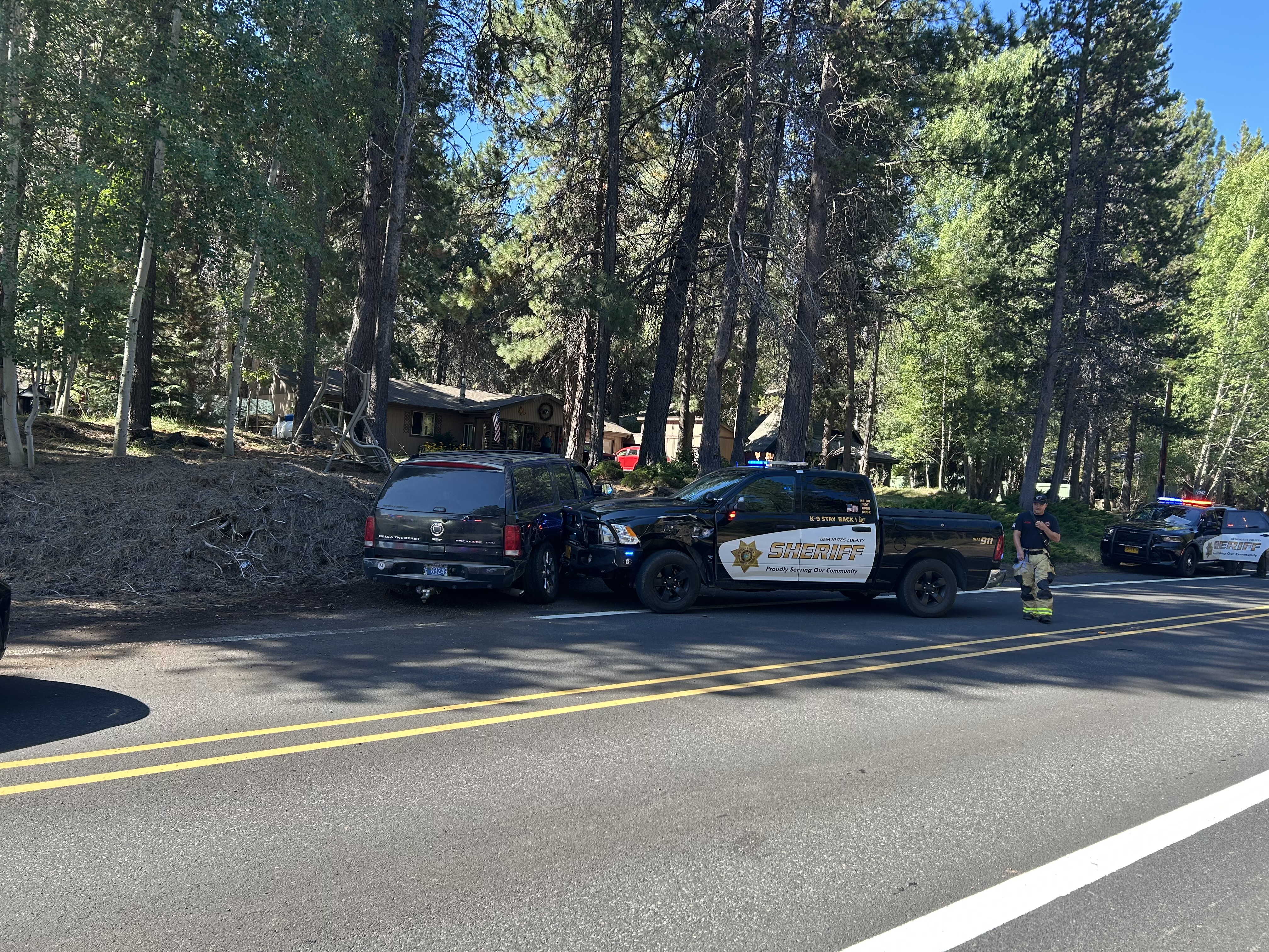
As Hammer fled down South Century Drive, Spring River Road, and nearby residential streets, he nearly struck multiple responding officers. He rammed a Deschutes County K-9 vehicle, causing damage and minor injuries to the Deputy inside. The K-9 was not injured. Hammer also drove onto private property, striking a parked vehicle while a resident was outside, before returning to the roadway.

As Hammer’s driving continued to endanger the public and law enforcement, Deputies re-engaged the vehicle. They used a Pursuit Intervention Technique (PIT) controlled maneuver to force the suspect off the road safely. Hammer drove into the PIT, and a Deputy pushed the Escalade onto the shoulder, ending the pursuit. Both the suspect’s vehicle and the Sheriff’s Office patrol vehicles were damaged.

Hammer was evaluated at the scene and later at St. Charles Medical Center before being lodged at the Deschutes County Adult Jail.

Oregon State Police is investigating the crash involving DCSO patrol vehicles, consistent with standard pursuit protocols. The Deschutes County Sheriff’s Office thanks the Sunriver Police Department, Oregon State Police, Sunriver Fire Department, and Deschutes County Road Department for their assistance during this incident.

ARRESTED: Matthew Hammer (DOB 9/24/1984)

CHARGES:

  • Attempted Assault I – 1 count

  • Attempted Assault on a Public Safety Officer – 3 counts

  • Recklessly Endangering – 5 counts

  • Reckless Driving – 3 counts

  • Attempt to Elude a Police Officer (Felony) – 3 counts

  • Criminal Mischief I – 1 count

  • Criminal Mischief II – 1 count

###